That gap matters for anyone accountable for model risk in a US bank or a mature fintech. A geolocation model is not a search box. It is a model, with a confidence distribution, a training bias, an owner, and a defensible use boundary. Treat it as anything less and you have quietly added an unvalidated inference to a claims or compliance decision.
Executive summary
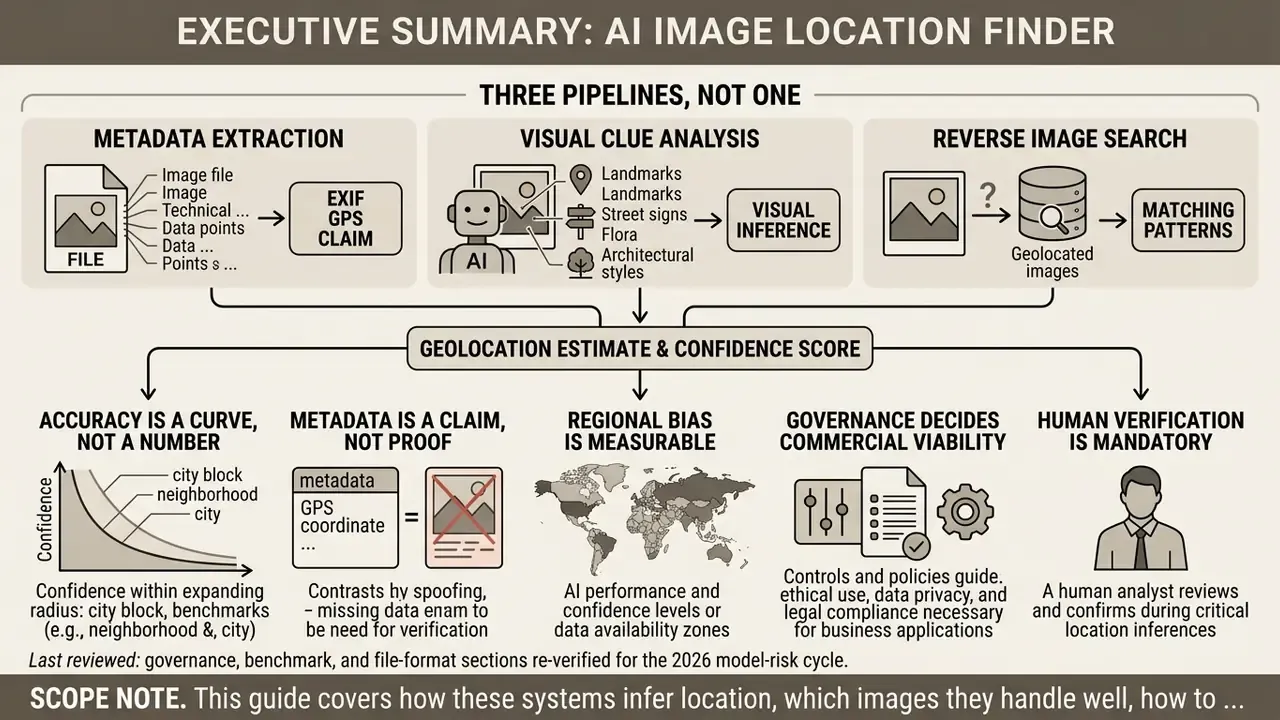
- Three pipelines, not one. An AI image location finder combines EXIF/GPS metadata extraction, computer-vision scene reasoning (CNNs, ViTs, LVLMs), and reverse image retrieval. Each pipeline fails differently, so each needs its own control.
- Accuracy is a curve, not a number. Independent benchmarks show roughly 32 percent accuracy at a 1-kilometer radius versus 86 percent at 750 kilometers. A precision claim without a stated radius is marketing, not measurement.
- Metadata is a claim, not proof. Forensic testing has recorded smartphone EXIF coordinate errors of 5 to 27 kilometers, and social platforms strip EXIF blocks entirely during upload.
- Regional bias is measurable. On uniform coastal imagery, accuracy inside 1 kilometer collapsed to roughly 1 percent, against 9.7 percent on diverse global datasets.
- Governance decides commercial viability. Zero-retention processing, role-based access, tamper-evident audit logs, and explicit Shadow AI controls matter more than a few points of model accuracy.
- Human verification is mandatory. Every automated output is a hypothesis until at least two independent physical markers are confirmed on satellite or street-level imagery.
Last reviewed: governance, benchmark, and file-format sections re-verified for the 2026 model-risk cycle.
Scope note. This guide covers how these systems infer location, which images they handle well, how to compare ai image geolocation tools for commercial deployment, what the published accuracy numbers actually mean, and what evidence to retain. It does not cover live tracking, and it deliberately avoids any workflow aimed at identifying private individuals.
What is an AI image location finder?
An AI image location finder is an automated system that infers the geographic origin of a photo by extracting embedded file metadata, processing visual scene content through computer vision models, or matching visual signatures against reference image databases. Organizations use these systems to estimate capture coordinates without leaning entirely on manual open-source intelligence (OSINT) work.
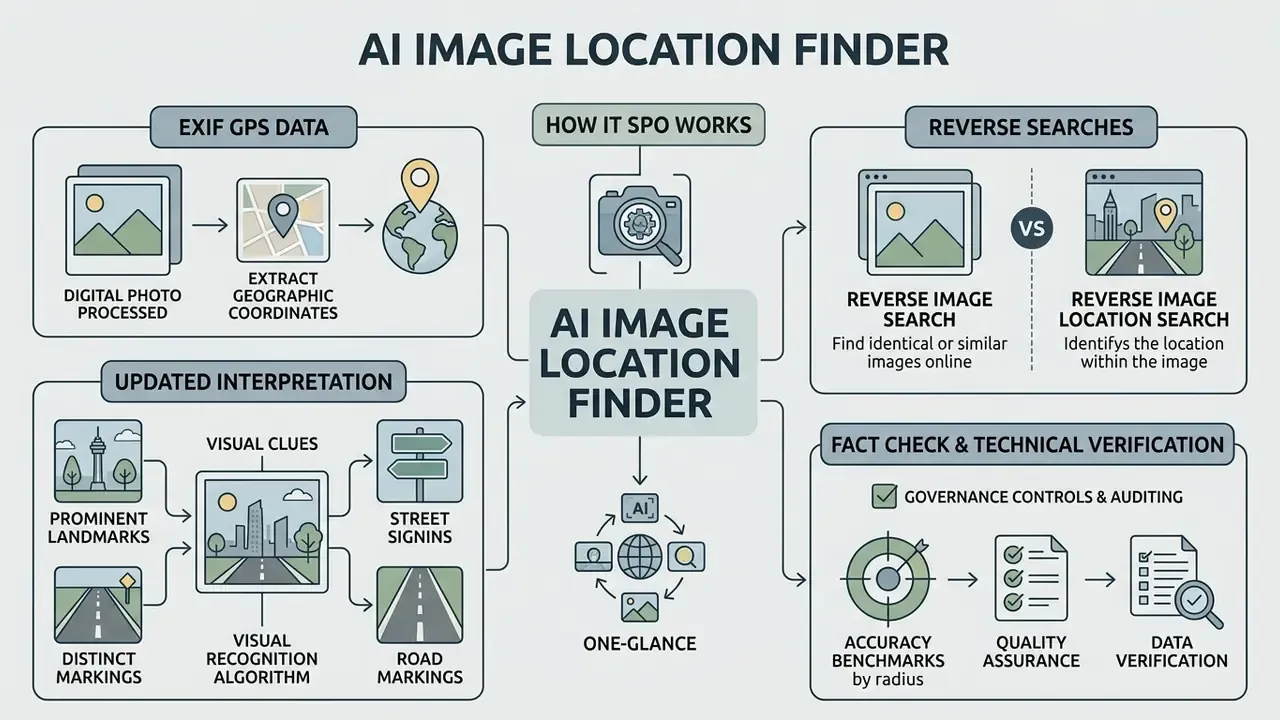
Modern tools combine three distinct technology pipelines to establish location probability:
- Metadata extraction reading EXIF header tags to recover recorded GPS latitude and longitude fields.
- Visual AI scene analysis using convolutional neural networks (CNNs), vision transformers (ViTs), and multimodal vision-language models (LVLMs) to weigh architectural style, vegetation, signage text, driving side, and infrastructure markers.
- Database retrieval running reverse image search and cross-view satellite matching against indexed reference imagery to test candidate locations.
Recent empirical benchmarks show that specialized geolocation architectures, such as PIGEON (Haas et al., CVPR 2024), achieve over 40 percent global accuracy within 25 kilometers on street-level imagery, using semantic geocell classification and contrastive pretraining.
Impressive, yes. Still probabilistic. The architectural direction across 2024 to 2026 research is a coarse-to-fine pipeline: candidate geocells are ranked first, then refined through re-ranking, retrieval, or explicit visual-language reasoning, rather than one-shot coordinate classification. For a governance reader, that design detail is useful, because it tells you where the uncertainty is introduced and which stage deserves logging.
EXIF GPS data: finding coordinates already stored in a photo
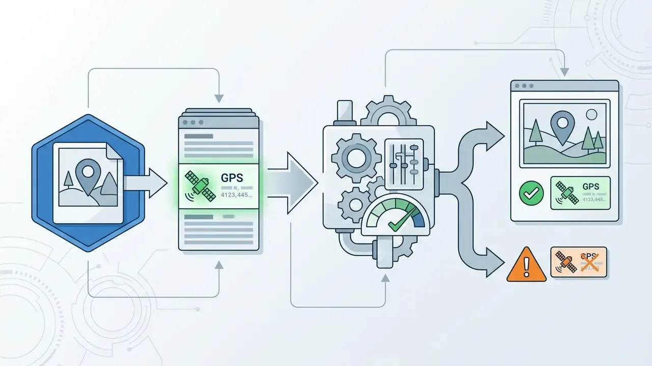
EXIF GPS metadata gives the exact physical coordinates where a digital photograph was captured, provided the values were recorded by camera hardware at the moment of exposure. This metadata sits in a dedicated Exchangeable Image File Format (EXIF) GPS Sub-IFD block inside the file header.
Standard EXIF GPS metadata stores latitude and longitude as three rational numeric values representing degrees, minutes, and seconds, with directional reference tags (N/S and E/W). Altitude is stored as a rational value in meters, qualified by GPSAltitudeRef to mark height above (0) or below (1) sea level. When intact, these tags let an ai location finder from image read numerical coordinates directly and pin the photo to a map within meters. Because the sign of a coordinate lives in the reference tag rather than the numeric value, an incomplete write that omits GPSLatitudeRef or GPSLongitudeRef produces an ambiguous, hemisphere-agnostic coordinate set. That failure is rare, but it is silent, which is worse.
GPS tags are optional fields, not mandatory file structures. Location data goes missing because device location services were off, satellite signal was obstructed during capture, or downstream software stripped the metadata block. Field forensics also show that when coordinates are present, they are not automatically trustworthy.
AI visual analysis of landmarks, signs and road markings
Reverse image search versus reverse image location search
Traditional reverse image search locates indexed duplicate files across web repositories. Reverse image location search evaluates scene content to infer geographic origin even when the photo has never been published anywhere.
Engines like Google Images or TinEye rely on perceptual hashing and feature vector matching against a web-crawled database; teams comparing retrieval coverage can review dedicated AI reverse image search tools before standardizing a workflow. Their job is finding where an identical or near-duplicate image already lives on the web.
If a photo is unpublished, private, or pulled from an internal corporate media archive, standard reverse search returns zero index matches. Which is exactly the situation most banks are in.
An ai image locator running visual geolocation treats the input as an unindexed scene instead. The model compares architectural, environmental, and structural features against spatial clusters and geocelled representations, producing coordinate estimates with no publication history required. The practical distinction sits in the question each method answers: reverse image search answers "what other images look like this," while visual geolocation answers "where was this photo taken." The first depends on index coverage. The second depends on scene interpretability.
Fact check and technical verification. EXIF GPS metadata is an unauthenticated, client-side data claim, not cryptographic proof. When metadata is absent, AI visual analysis produces a probabilistic geographic hypothesis with an inherent margin of error and requires independent cross-verification before any operational reliance.
Understanding how these three technologies fail is what shapes the verification procedure. Metadata can be stripped or displaced, visual reasoning can hallucinate, and index retrieval can return nothing at all. Enterprise workflows therefore sequence the methods deliberately rather than running them ad hoc. The procedure below reflects that sequencing.
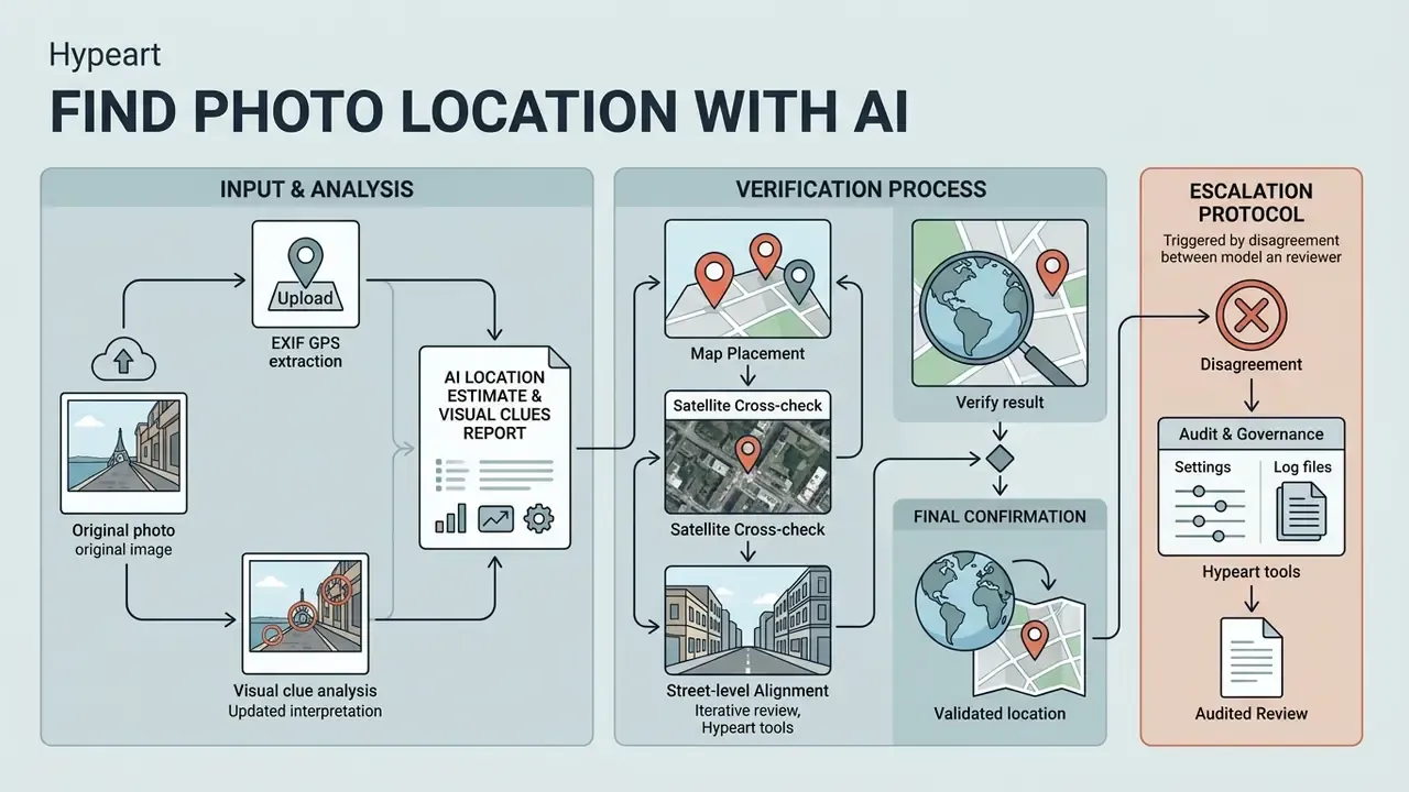
Upload the original image when possible
Uploading the original, unmodified file preserves metadata headers and full pixel resolution, which raises the quality of everything downstream. Re-encoded files and screenshots routinely strip EXIF tags and compress the very details needed for precise inference.
When photos pass through messaging channels or social platforms, standard image-processing pipelines remove EXIF GPS headers to protect user privacy.
Review the AI location estimate and visual clues report
Reviewing the estimate means analyzing candidate coordinates alongside confidence scores and supporting visual evidence, not accepting the top-ranked prediction as fact.
Modern geolocation architectures return structured reports containing:
- Ranked location candidates: coordinates paired with estimated probability distributions across country, regional, or municipal boundaries.
- Confidence levels: calibrated percentage scores reflecting training data density and visual cue clarity.
- Visual clues breakdown: the specific scene features the model relied on, such as signage language, driving orientation, architectural classification, or utility pole configuration.
In practice, operators test whether the cited visual cues logically fit the proposed region. If an ai photo location finder proposes a specific European municipality at 82 percent confidence, the reviewer checks whether the identified signage scripts and road marking conventions actually match national standards for that jurisdiction. Sometimes they do not, and the confidence number never flinches.
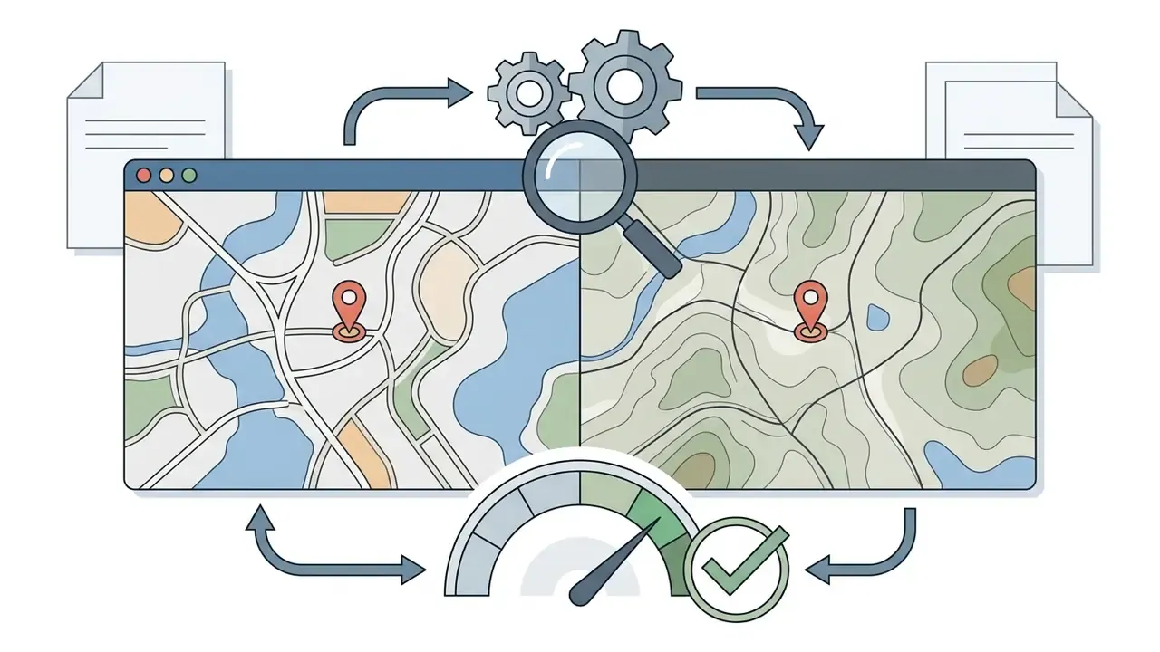
Verify the result with maps, satellite view and Street View
Verification means independently cross-referencing candidate coordinates against satellite imagery, mapping databases, and street-level panoramas to confirm feature alignment.
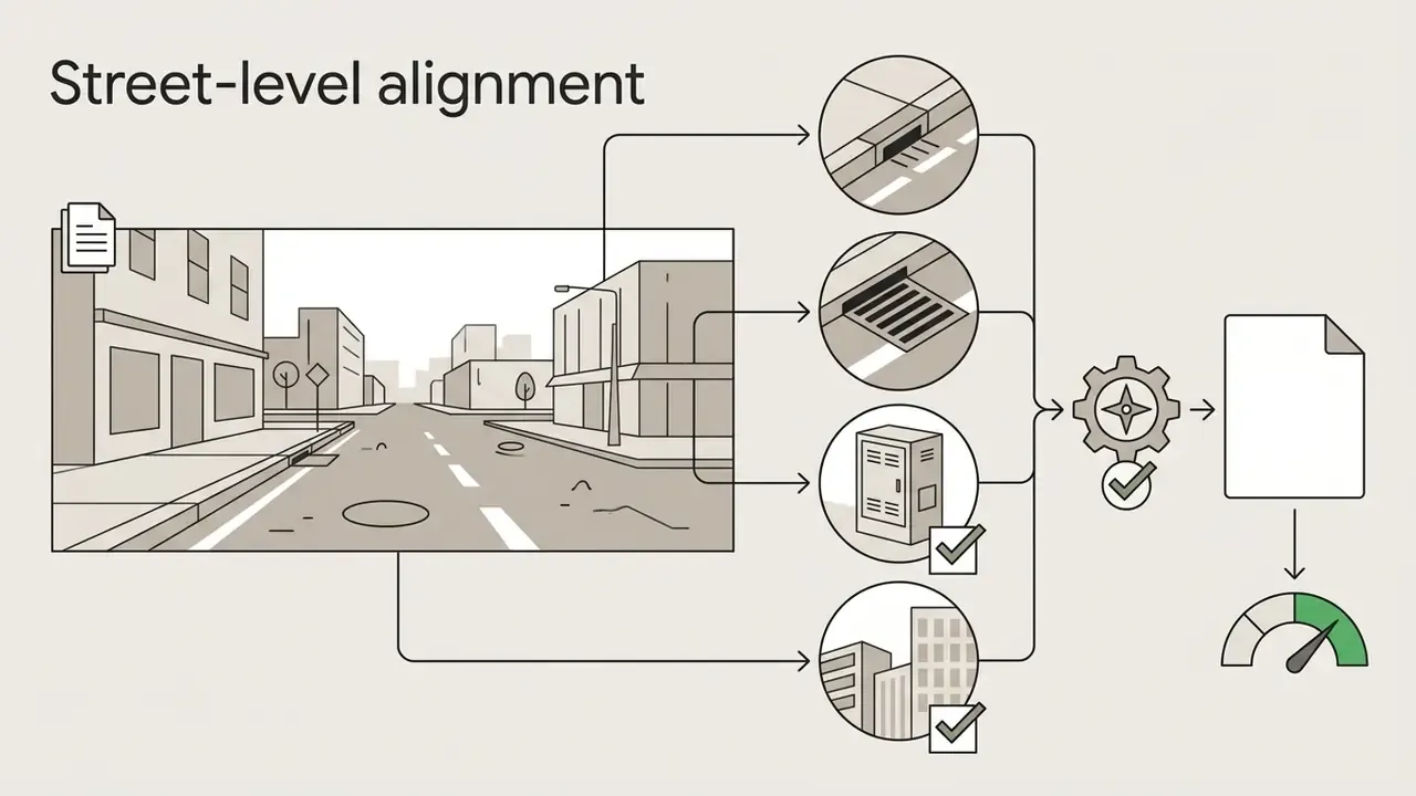
The manual validation sequence runs in three steps:
Verification depends on features that were not part of the original hypothesis. Matching independent secondary structures is what converts a guess into a finding. Professional practice requires at least two to three corroborating visual matches, plus saved screenshots, map links, timestamps, and coordinates, before treating a location as established.

Escalation protocol when the model and the reviewer disagree
Which images work best for AI photo location finding?
Images that work best carry clear structural context, legible signage, distinctive architecture, and standardized infrastructure. Scenes without unique anchors return broad regional hypotheses instead of specific coordinates.
| Image category and composition | Key geographic signals present | Expected AI output granularity | Primary verification method |
|---|---|---|---|
| Travel photo with cityscape (high-res JPG with EXIF) | Unique landmarks, skyline contours, shop signage, intact EXIF GPS tags | Exact street address or coordinates within 10 to 50 meters | Map coordinate plotting, Street View alignment |
| Urban street scene (moderate-res PNG/JPG) | Readable text, driving orientation, license plate formats, road markings | Municipal or neighborhood level (1 to 10 km radius) | OCR sign lookup, infrastructure matching |
| Rural roadway or highway (standard WebP/JPG) | Highway sign layouts, lane line colors, utility pole style, guardrail design | Regional or state highway candidate corridor | Satellite road network alignment, terrain check |
| Featureless natural landscape (plain beach or forest) | Soil color, broad vegetation type, shoreline silhouette | Country, coastline, or climate zone estimate | Topographic map overlay, regional vegetation rules |
| Indoor room or studio shot | Electrical socket designs, furniture style, window frame proportions | Broad cultural region, or unlocatable | Contextual metadata review, external log cross-check |
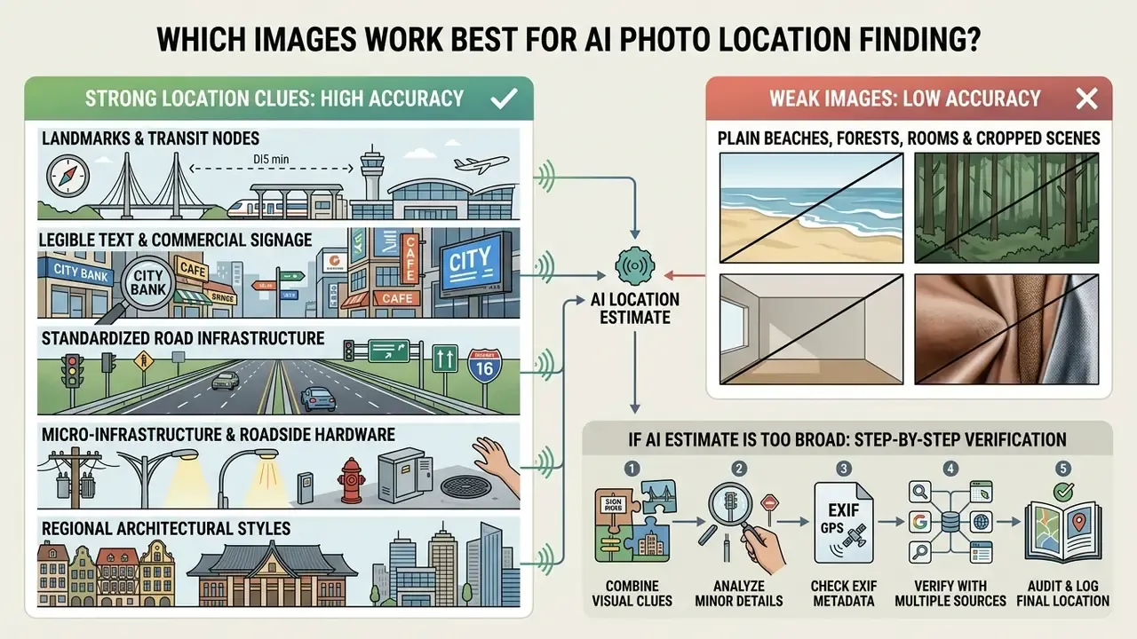
That gap quantifies something vendors rarely say out loud: image selection, not model selection, is usually the dominant accuracy variable in production.
Strong location clues: landmarks, text, architecture and road markings
Strong clues are fixed, heavily regulated, or geographically unique elements that sharply narrow the spatial search space.
Primary visual markers include:
- Distinctive landmarks and transit nodes train stations, bus interchanges, airports, bridge spans, government buildings, and monuments recorded in global spatial registries. Benchmark testing identifies fixed transit infrastructure as the single most accurate cue class, because such nodes are both unique and immobile.
- Legible text and commercial signage storefront names, directional road signs, station plates, and regional language scripts that point straight at administrative districts.
- Standardized road infrastructure lane line coloring (yellow center lines versus white borders, for instance), pavement markings, driving side, street lamp styles, and traffic signal mountings.
- Micro-infrastructure and roadside hardware the shape and color conventions of highway bollards (including reflector designs unique to particular European or South American countries), utility pole cross-arm configurations, street-lighting brackets, guardrail profiles, and regional license plate aspect ratios and color bands. Vehicle make, model, and body-style mix in the frame can narrow a candidate region further when signage is absent.
- Regional architectural styles roof tiling materials, balcony norms, fence lattice patterns, and historic masonry typical of specific zones.
When an ai picture location finder receives an input with several overlapping strong markers, the reasoning stage collapses candidate geocells quickly and produces street-level hypotheses worth verifying.
Weak images: plain beaches, forests, rooms and cropped scenes
Weak images carry generic, repetitive, or unconstrained textures with no unique spatial anchor. Low confidence and wide output boundaries follow.
What to do if the initial AI location estimate is too broad
When the model returns a wide bounding box, say country-level output or a radius above 500 kilometers, run a targeted re-cropping sequence instead of resubmitting the same frame:
- Isolate anchor infrastructurecrop out generic natural background (sky, open grass, plain water) and zoom to static man-made objects such as utility poles, road bollards, unusual fence lattices, or drainage covers.
- Isolate readable signagecrop tightly around background text, station plates, or license plates, applying contrast enhancement before resubmitting to the OCR engine.
- Segment dual-feature promptsif the photo holds both architecture and terrain, submit two separate cropped runs, one strictly on structural motifs and one on topographic horizons, then compare overlapping candidate geocells.
- Log every crop as a derivative artifactrecord the parent file hash, crop coordinates, and any enhancement applied, so the evidence chain stays reconstructable during review.
A small sign, an odd lane marking, a coastline silhouette, or one utility pole often carries more geographic signal than the nominal subject of the photograph.
Supported image formats and file quality
Supported formats for automated location processing include the standard raster types: JPEG, PNG, WebP, and HEIC, assuming pixel clarity and file structure survive intact.
Technical requirements shape accuracy directly:


Model performance scales with input resolution and sharpness. A long edge above 1920 pixels keeps distant signage legible for OCR and infrastructure classification; commercial imaging standards tie detail retention to 300 ppi and long-edge minimums above 2400 pixels. Where the source is soft or noisy rather than simply small, an AI image enhancer can lift local contrast and edge definition before geolocation analysis. Downsampling below 800 pixels degrades feature extraction badly, forcing the algorithm back onto coarse color and landscape texture.
How to choose an AI image geolocation tool for commercial use
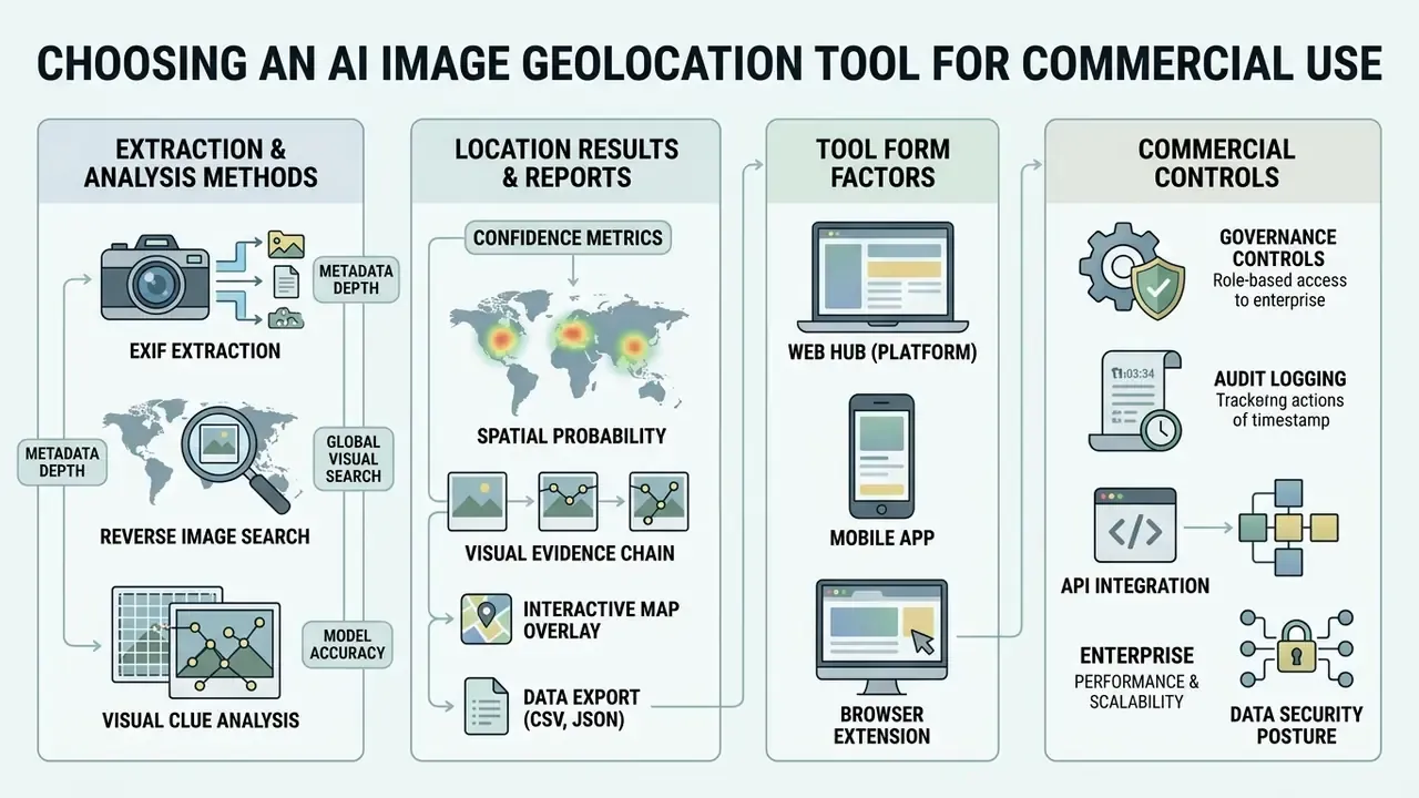
Selecting an enterprise tool means weighing visual model accuracy, metadata processing depth, API integration, data security posture, and audit logging. For regulated buyers, the control surface usually outranks the leaderboard score. Teams comparing categories side by side can also view the guide on evaluation criteria before shortlisting vendors.
Visual AI, EXIF extraction and reverse search: what each method can do
Enterprise platforms combine metadata reading, deep learning vision, and reverse lookup to squeeze intelligence out of whatever arrives in the queue.
That spread is a useful reference point when a vendor quotes accuracy with no radius attached.
Each method does a specific job:
- EXIF extraction: instantly reads camera parameters, timestamps, and GPS coordinates. Highly accurate when the data exists, useless once headers are stripped.
- Visual AI scene reasoning: evaluates pixel content against trained spatial embeddings. Works on unpublished, private, or metadata-stripped files, producing probabilistic geographic hypotheses.
- Reverse image indexing: scans external web indices for published duplicates, original captions, and historical media context.
Integrated platforms route uploaded media through all three engines at once, consolidating metadata records, visual clue reports, and index matches into a single analytical view. Consolidation is also what makes the run auditable, since one case record holds every input and output.
Tool form factors: web hub, mobile app or browser extension
Technology choice is only half the decision. The delivery form factor determines who can run an analysis, where the file physically travels, and whether the action leaves a trace.
| Tool form factor | EXIF metadata extraction | Visual AI scene reasoning | Privacy and data retention control | Primary commercial use case |
|---|---|---|---|---|
| Enterprise web hub or API | Full (raw header parsing) | High (multi-model ensembles) | Zero-retention or on-premises option | Corporate OSINT, forensic audits, automated asset tagging |
| Mobile app (iOS / Android) | Direct camera ingest | Moderate (optimized mobile vision) | Variable (local versus cloud processing) | Field investigations, on-the-go media verification |
| Browser extension or EXIF viewer | Client-side extraction | Low or none (metadata only) | High (runs locally in the browser) | Rapid web media screening, journalistic fact-checking |
Mobile apps are convenient in the field and frequently lack exportable audit logs. Browser-side EXIF viewers keep files local but cannot perform visual inference. Enterprise APIs give the strongest control surface, at the cost of integration effort. Pick the one your auditors can read.
What to look for in location results and reports
Shadow AI and data ingestion risks
The largest practical exposure here is rarely model error. It is unmanaged ingestion. When employees upload branch-office photographs, claim documentation, customer property images, or internal facility shots into consumer geolocation websites, the organization loses control of both the file and its metadata in a single click.
Controls that measurably reduce Shadow AI exposure:
- Maintain a sanctioned tool register. Record every approved geolocation service in the AI system inventory, with processing location, retention period, and contractual basis documented.
- Block unsanctioned endpoints at the network layer. Consumer "where was this photo taken" upload domains belong in the same category as unmanaged file-sharing services.
- Classify imagery before upload. Photographs showing customers, employees, security infrastructure, or non-public premises should stay out of cloud processing entirely and route to on-premises or vendor zero-retention pipelines.
- Instrument detection, not just prohibition. Egress monitoring for image uploads to unapproved domains catches policy drift far earlier than annual attestation.
- Train on the failure mode, not the tool. Staff should grasp that one uploaded facility photo can reveal a precise location. That is the same mechanism that makes these tools valuable for investigations. Cuts both ways.
Workflow owners standardizing intake rules across teams can browse the hub for process templates.
Privacy, uploaded images and responsible commercial use



Compliance alert. Using an ai tool to identify location from image for unauthorized surveillance, doxxing, real-time individual tracking, or stalking violates platform terms, data privacy frameworks (GDPR Art. 6), and federal anti-harassment regulation. Published responsible-use policies in this category explicitly prohibit real-time tracking, surveillance, doxxing, harassment, intimidation, and blackmail. Commercial deployment must stay inside legitimate legal, investigative, and compliance boundaries.
How accurate is AI location identification?
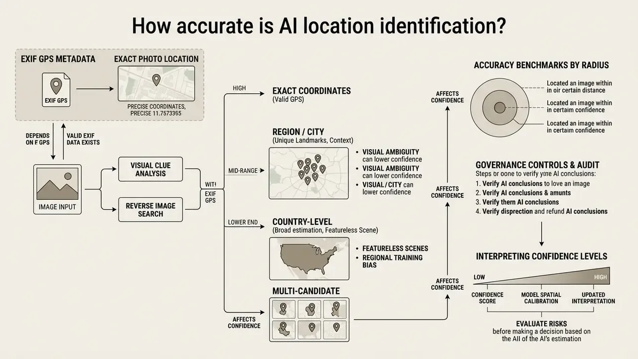
Accuracy ranges from exact coordinate pinpointing, when valid EXIF GPS metadata exists, to broad country-level estimation for featureless scenes. It depends on metadata integrity, visual cue density, and the geographic coverage of the training data.
When GPS metadata can provide an exact photo location
GPS metadata delivers sub-10-meter accuracy when intact, internally consistent EXIF headers were written by camera hardware under good signal conditions.
With valid tags present, an ai picture locator reads latitude and longitude directly, and probabilistic guesswork never enters the picture. Operators still have to check internal consistency.
Inconsistent device timestamps, altered software tags, or conflict between recorded coordinates and visible scene elements suggest EXIF spoofing or metadata manipulation. Practical spoofing indicators: GPS values that contradict visible architecture or vegetation, device-model fields inconsistent with image dimensions, editing-software tags added after capture, and sun-angle estimates that clash with the recorded timestamp.
Why AI may return a country, region or several map candidates
Models output broad bounds or multiple candidates when the input shows spatial ambiguity, repetitive elements, or under-represented geographic features.
Main drivers:
- Visual ambiguity uniform architecture, generic highway corridors, and wide agricultural terrain repeat across many nations.
- Model spatial calibration well-calibrated networks widen prediction bounds for scenes far from their training clusters, returning a regional bounding box instead of a falsely confident point.
- Regional training bias models trained mainly on North American and European media perform better there and hedge elsewhere.
How to interpret confidence levels before making a decision
Confidence levels reflect statistical probability shaped by training distribution density. They are not a guarantee of spatial correctness.
Popular ways to use an AI picture location finder
Organizations and research analysts deploy ai tools to determine photo location across a range of workflows, automating scene verification and supporting open-source research.
Unfamiliar with a term used above? You can open the hub for definitions of geocell, EXIF, and cross-view matching.
- Media verification and fact-checking
- news agencies and forensic teams geolocate viral uploads to test event origin claims and counter disinformation. Verification desks increasingly pair location analysis with an AI image detector to rule out synthetic imagery before publication.
- OSINT and digital forensics
- analysts process metadata-stripped media to identify conflict zones, environmental compliance violations, or asset locations.
- Historical archive cataloging
- museums and research institutions analyze uncaptioned photography archives, identifying city regions through architectural classification.
- Insurance and claims validation
- adjusters review property damage photos, cross-referencing scene architecture and regional vegetation against the reported claim location.
- Financial crime and merchant diligence
- onboarding teams sanity-check submitted premises photographs against declared business addresses, as one signal among many, never as a standalone adverse decision.
- Personal travel planning and photo verification
- identifying scenic spots from uncaptioned social images to build an itinerary, or checking whether a vacation photo or marketplace listing image was genuinely taken where it claims.
- Travel and digital asset management
- content platforms auto-tag unmapped travel media and organize catalogs by regional origin.
FAQ: finding photo location with AI
Can AI find a location from a screenshot?
Yes. AI can estimate location from a screenshot by reading visible visual clues in the pixels, but it cannot extract EXIF GPS metadata.
A screenshot is a new image file carrying display render parameters, not original camera metadata. So an ai to find location from photo task on a screenshot rests entirely on computer vision: visible building architecture, readable signage, language scripts, road infrastructure, and even UI context elements inside the captured frame.
«Document the absence of EXIF as "expected for a screenshot" rather than as evidence of manipulation, then proceed to visual analysis and reverse search.» Whereisthis.place OSINT Photo Geolocation Workflow, 2024 to 2025. https://www.whereisthis.place/blog/osint-geolocation-workflow
For better screenshot results, capture full-screen uncropped renders to keep the maximum amount of background detail.
Can AI locate a photo taken from a video frame or social media clip?
Yes. Still frames from TikTok, YouTube Shorts, or Instagram Reels can be geolocated. Video compression strips camera metadata completely, so the work relies strictly on visual scene analysis. To maximize accuracy, extract the highest-resolution keyframe available and avoid active motion-blur frames, make sure structural elements such as street lights, storefront signs, or road markings render sharply, and submit the uncropped frame first to preserve aspect-ratio context. If the first estimate is broad, apply the re-cropping protocol above to isolate signage or fixed infrastructure, and pull several frames from different moments in the clip. Parallax between frames often exposes anchors invisible in any single still.
Can you identify location from social media photos?
Yes, using visual scene reasoning, even though platforms strip EXIF GPS metadata during upload.
When media is published, automated server pipelines re-encode files and remove EXIF headers to protect user privacy.
«Sort reverse-search results by publication date: an earlier version with a different caption is the most common route to establishing the origin of a viral image.» Geospys OSINT Photo Geolocation Workflow, 2024 to 2025. https://www.geospys.com/post/osint-photo-geolocation-workflow
Geolocation tools work around missing metadata through visual feature extraction, reading street layouts, storefront text, signage styles, and environmental markers. Analysts routinely combine those hypotheses with reverse lookup to find the original high-resolution upload or its caption, and use an image to text converter to turn signage into searchable strings. For foreign-script signage, an image to text translator speeds up the transcription step considerably.
Does an iPhone HEIC file keep its GPS coordinates?
Yes, provided location services were on at capture and the file has not been re-encoded. HEIC containers carry the full EXIF GPS Sub-IFD block, so an unmodified .heic file transferred directly from the device, or via AirDrop or document-mode messaging, usually retains exact latitude, longitude, and altitude. The failure point is conversion: many web converters and export presets drop the metadata block when producing JPEG or PNG. Verify the presence of GPS tags after conversion rather than assuming preservation.
What percentage of online images still contain EXIF metadata?
Published measurements vary widely by sample and by definition. One web-crawl study of 6,845 images found location metadata in just 14 files, roughly 0.2 percent, while a separate sample of more than 40 million online images reported that 15 percent retained some metadata and 85 percent retained none. The divergence reflects different definitions, "any metadata" versus "geotag specifically", and different sampling frames. The operational takeaway does not change: assume metadata is absent and design the workflow around visual evidence.
Can geolocation output be used as the basis for a customer decision?
Not on its own. A geolocation estimate is an inference with a measurable error distribution, so it belongs in the evidence file as a supporting signal, with its radius and confidence tier recorded. Adverse actions affecting a customer should rest on independently verified facts, documented human review, and the escalation path your model-risk policy already defines for probabilistic outputs.
Audit trail checklist for geolocation findings
Copy this into the case record for every geolocation analysis meant to support a business, editorial, or regulatory decision:
Checklist0 / 11
Control mapping, limitations and open questions
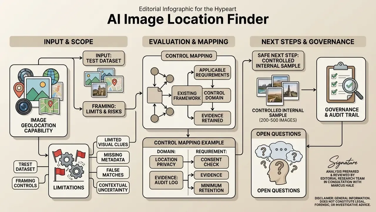
Where does an image geolocation capability sit inside an existing framework? Roughly here:
| Control domain | Applicable requirement style | Minimum evidence to retain |
|---|---|---|
| AI system inventory | Registration of every third-party inference service in use | Tool name, vendor, model version, processing region, retention terms |
| Model validation | Periodic performance review of third-party models (SR 11-7 style) | Accuracy by radius on internal sample, override rate, escalation log |
| Data protection | Lawful basis and minimization for identifiable imagery | Purpose statement, access authorization, deletion confirmation |
| Security and Shadow AI | Egress control and sanctioned-tool enforcement | Blocked-domain list, upload monitoring alerts, exception approvals |
| Human oversight | Documented human-in-the-loop decision point | Reviewer identity, verification markers, final confidence tier |
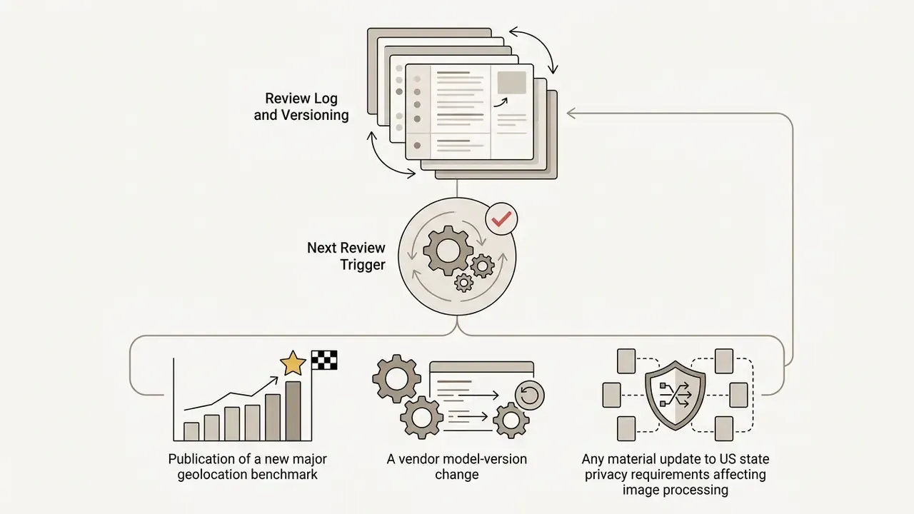
Review log and versioning