Reviewed by: Marcus Hale, Head of Model Risk and Visual AI Governance. Marcus Hale, author. Botanical review input came from a licensed landscape architect working with site trial data across twelve suburban properties.
Last updated: February 2026. Regulatory references (EU AI Act Article 50, US Copyright Office guidance) were checked against the currently published texts.
Executive Summary
«Visual AI tools let teams and property owners convert static site photographs into actionable design concepts within seconds. Drawing a clear operational boundary between preliminary visual ideation and engineered site construction remains essential for risk management.»
A quick note on framing. This guide is written for two readers at once: the homeowner who wants a fast look at a new patio, and the professional who has to defend that render in front of a client, a compliance officer, or a planning authority.





What Is an AI Landscape Generator From Photo?
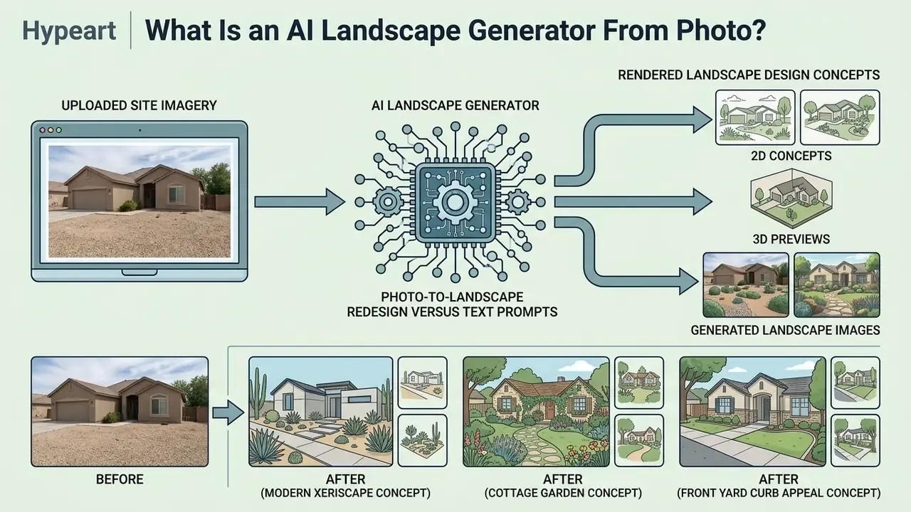
An ai landscape generator from photo is a specialised application of generative AI that converts uploaded site imagery into rendered landscape design concepts. These tools use computer vision to segment structural elements such as lawns, fences, and hardscapes, then deploy diffusion models to overlay new planting schemes, patios, and architectural features while holding the base perspective of the original property in place.
Recent guidance from the USDA Forest Service makes a similar point: generative AI workflows speed up option generation and stakeholder engagement during initial site planning (USDA Forest Service, "Leveraging Generative AI for Landscape Planning"). Rather than replacing formal planning, an ai landscape creator works as an interactive ideation engine for testing visual potential before capital is committed. The American Society of Landscape Architects reinforces that position in its 2025 policy statement: AI is not a substitute for human judgment, creativity, or professional responsibility.
Worth stressing, because it gets lost in marketing copy: the model is guessing what a plausible garden looks like. It is not calculating anything.
Photo-to-landscape redesign versus text prompts
Photo-to-landscape redesign relies on an upload image workflow that anchors every visual transformation in real site geometry. Pure text-prompt generation, by contrast, invents an arbitrary scene from scratch. In an image-conditioned pipeline, latent diffusion models treat the input photograph as a spatial framework, then apply ai image remover techniques or targeted inpainting to modify specific zones without shifting the camera angle or the structural boundaries.
«UrbanGenAI combines OneFormer panoptic segmentation with ControlNet over SDXL, achieving high IoU and CLIP scores when reconstructing urban landscapes.»
2D concepts, 3D previews and generated landscape images
An ai 3d landscape generator turns flat 2D site photographs into depth-aware 3D previews and high resolution presentation renders. The pipeline reads 2D site plans or elevation photos, estimates spatial massing and light angles, and projects realistic textures across ground planes and vertical structures.
Research published in PlantoGraphy shows that multi-stage pipelines, which combine schematic layouts with fine-tuned diffusion models, let users review prospective site changes from perspective angles well before formal drafting begins.
The output gives you high quality visuals for exploring design alternatives, and it gives non-designers something rare: a believable preview of spatial balance and material combinations, produced with no design experience at all.


How to Generate a Landscape Design From a Photo
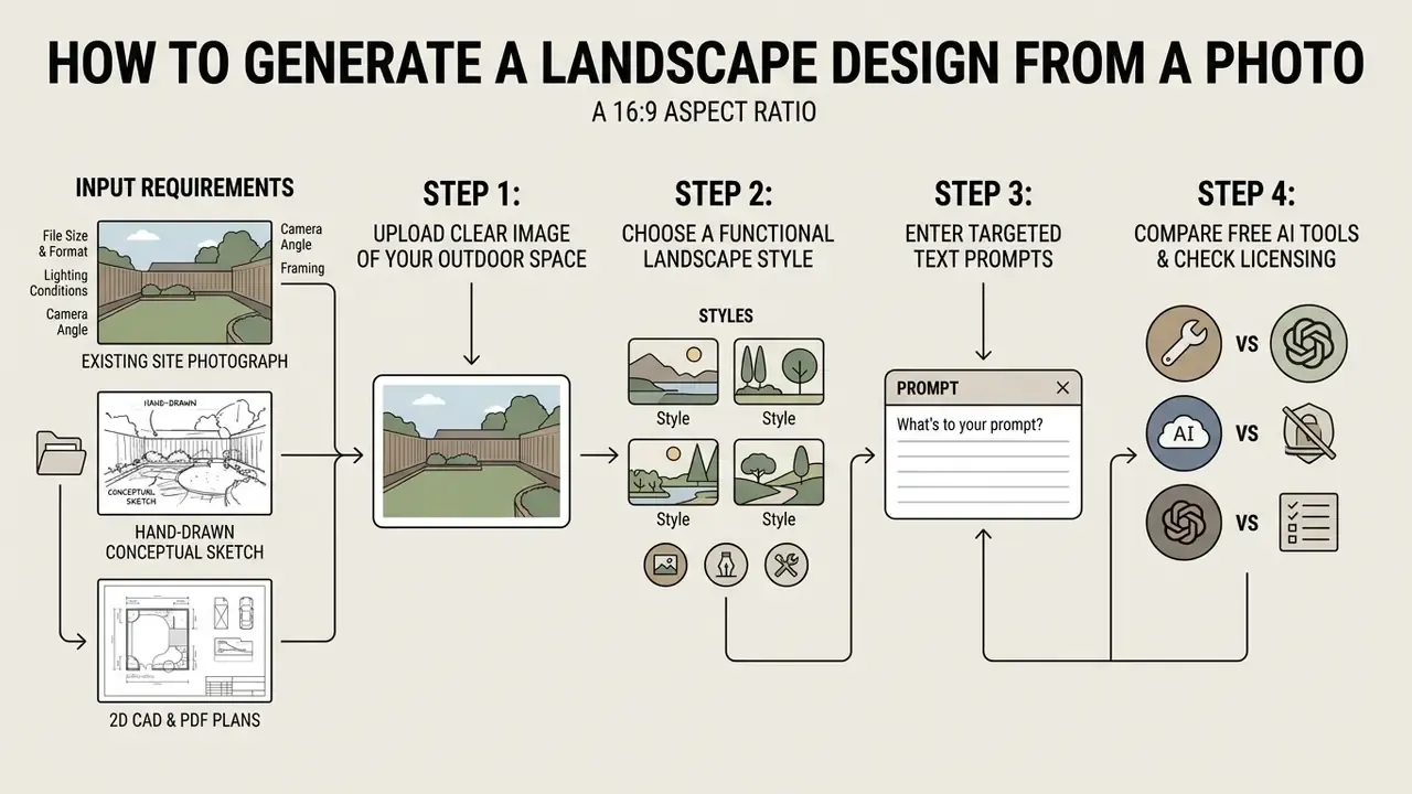
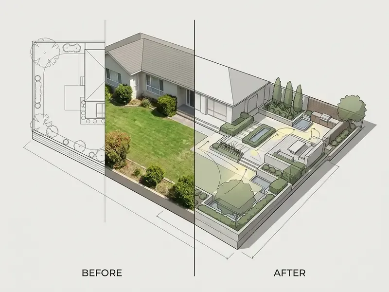
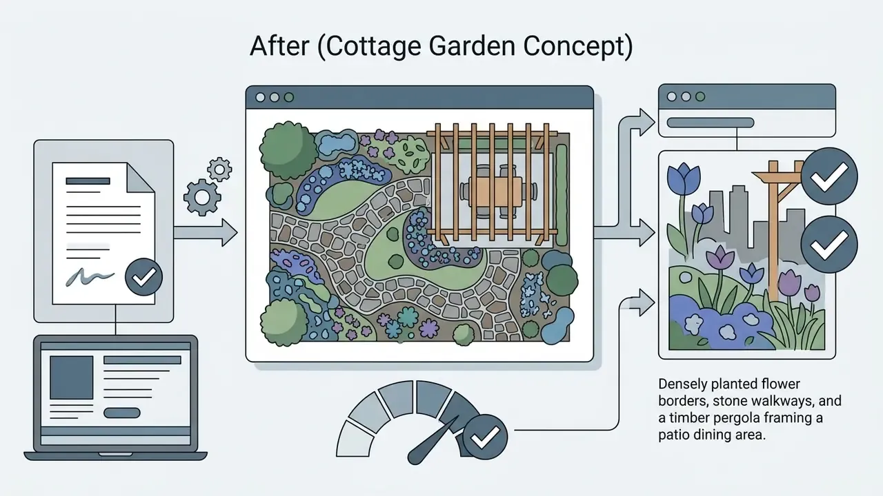
Generating a landscape design from a photo comes down to four moves: upload a clear image of your outdoor space, choose a functional landscape style, enter targeted text prompts, and refine the outputs. Online platforms push those inputs through diffusion pipelines and return photorealistic renders in seconds.
To explore related editing capabilities across commercial workflows, you can see the overview of available generative utilities.
Input requirements: photos, sketches, and plan drawings
High-contrast daylight photographs still yield the most reliable depth maps. But modern pipelines accept a much broader spectrum of visual inputs than most users expect. You can upload:
- Existing site photographs Standard JPG, PNG, or WebP, commonly accepted up to 50MB, though some tools cap at 16MB per file.
- Hand-drawn conceptual sketches Raw pencil layouts or marker site overlays. Diffusion models extrapolate material textures while preserving the basic geometry you drew.
- 2D CAD and PDF architectural plans Overhead site boundaries and vector plans converted via edge-detection models into perspective 3D previews. Professional suites additionally ingest DWG and IFC, and export layered PNG, TIFF, or PSD.
Technical upload checklist:
If a frame arrives at the wrong aspect ratio for a client deck, an ai image resizer is a safer fix than re-cropping the original and losing the boundary line.
Upload a clear photo of the outdoor space
Good generation starts with a clear, high-contrast photograph of the front yard, backyard patio, garden, or pool area. Shoot in daylight, from a frontal or near-frontal position, showing complete boundary lines without severe lens distortion or physical clutter.
Computer vision input standards point to flat lighting and sharp focus as the way to reduce artificial detail corruption during feature segmentation. This is an architectural constraint, not a stylistic preference:
When the base photo clearly marks ground boundaries and structural edges, the ai landscape photo generator can tell editable regions apart from fixed structures such as main house walls or a neighbour's property. If the only available frame is underexposed or noisy, run it through general-purpose AI photo editors to correct exposure and sharpness first.
Photo preparation, do's and don'ts
| Do | Don't |
|---|---|
| Shoot between mid-morning and mid-afternoon in diffuse daylight | Shoot into direct backlight or at night with flash |
| Stand back far enough to capture the full plot boundary | Crop the frame tightly around one flower bed |
| Hold the camera roughly at chest height, level to the ground | Tilt the phone sharply up or down, which creates keystone distortion |
| Clear hoses, bins, toys, and vehicles from the frame | Leave clutter and expect the model to read it as design intent |
| Use the native camera at full resolution | Use screenshots, compressed messenger exports, or zoomed crops |
| Take two to four frames of the same zone from different positions | Rely on a single blurred frame for a large or irregular site |
Choose the landscape type, style and design direction
Selecting a landscape type and a design direction sets the conditional boundaries for the model. It drives plant selection, hardscape materials, and spatial layout. Platforms ship preset categories that run from low-maintenance xeriscapes to formal modern patios and traditional cottage gardens.
Naming functional areas helps too. Say "outdoor dining terrace" or "low-water lawn replacement" and the tool picks context-appropriate materials instead of generic greenery. Combining preset style filters with descriptive prompts keeps the generated output aligned with both taste and practical site constraints.
«SDXL uses a two-stage base plus refiner architecture for complex prompts; SD3 adds multimodal training, improving compositional consistency across styles.»
Generate, compare and refine design ideas
The generation phase produces several visual variations in parallel, so you can weigh spatial arrangements side by side. Iterative refinement follows: adjust prompt parameters, mask and swap individual elements, or lower the transformation strength to retain more of the original site structure.
A standard optimisation loop looks like this. Generate three or four initial variants, pick the strongest layout, then use targeted inpainting to tune details such as plant density or surface texture. Property owners and designers get to test multiple design ideas before anyone spends money on site prep.
That finding is counterintuitive, and it holds up in practice. A slightly rough render invites the client to argue with it.
Practical prompt engineering for landscape rendering
For predictable output, structure the prompt: explicit design instructions on one side, rigid negative boundaries on the other.
Standard prompt formula:
[Space type] + [Landscape style] + [Specific hardscape materials] + [Plant species / vegetation] + [Lighting / atmosphere]
Copy-paste prompt examples:
- Modern xeriscape: "Suburban backyard patio, modern xeriscape design, smooth poured-concrete pavers, gravel mulch groundcover, agaves and blue fescue grasses, warm dusk LED landscape lighting, photorealistic 8k render."
- Cottage patio: "Small backyard terrace, English cottage garden style, weathered flagstone walkway, dense climbing roses on timber trellis, lavender borders, bright morning sunlight."
- Poolside upgrade: "Rear yard inground pool surround, Mediterranean style, travertine pavers, olive trees in terracotta pots, low screen hedging, shade pergola, golden hour sunlight."
Recommended negative prompts (what to exclude):
Drop these into the negative prompt field to kill the most common rendering errors:
plastic furniture, dead grass, patchy soil, distorted fences, unnatural oversaturated greens, blurry textures, misplaced indoor furniture, floating pavers, duplicated doors.
Controlling light, season and mood: Environment-only prompt edits keep geometry intact while changing atmosphere. Use explicit terms such as "daytime", "dusk", "golden hour sunlight", "blue hour twilight", "overcast diffuse light", "spring soft cool returning light", "October dusk with fallen leaves", or "light morning mist, volumetric light beams".
- Step 1: Upload photo, sketch or PDF plan.Select a bright, uncropped photo of the yard, or import a hand sketch or 2D site plan (up to 50MB).
- Step 2: Define boundaries and masking.Mark zones for turf, hardscape, or garden beds using brush tools or automated segmentation.
- Step 3: Select style and prompts.Choose a style preset (Modern, Xeriscape, Japanese Zen) and add text prompts for lighting and materials, plus negative prompts.
- Step 4: Instant generation.Run the ai landscape generator online to create three or four iterations in 15 to 30 seconds.
- Step 5: Compare and refine.Review variants side by side, adjust prompts for localised changes, and export the final renders as PNG, JPG, or SVG.
Which Outdoor Spaces and Landscape Styles Can AI Visualize?
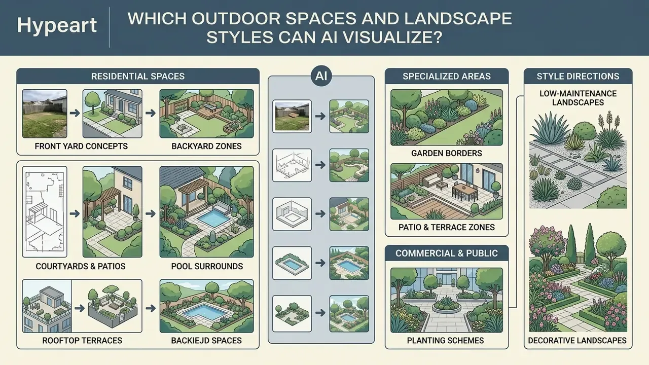
An ai image generator for landscaping can visualise almost any residential or commercial outdoor zone: front yards, backyards, courtyards, patios, pool surrounds. The underlying generative models adapt to a wide range of landscape styles and synthesize textures from minimalist hardscape to dense botanical planting. Teams weighing render fidelity across platforms can review our comparison of AI image generators before standardising on one engine.
Front yard, backyard, garden and patio concepts
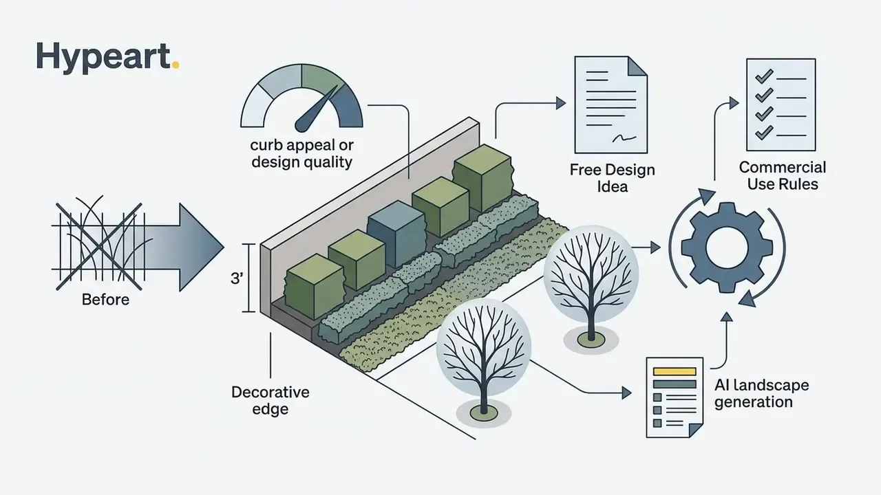
Front yard visualisers lean hard into curb appeal, site symmetry, and entry pathways, swapping worn lawns for structured low-profile planting or decorative boundaries. Backyard design work goes the other way, prioritising private living space: outdoor kitchens, seating areas, fire pits, and functional turf zones.
For specialised areas, an ai generator landscape workflow synthesizes specific features:
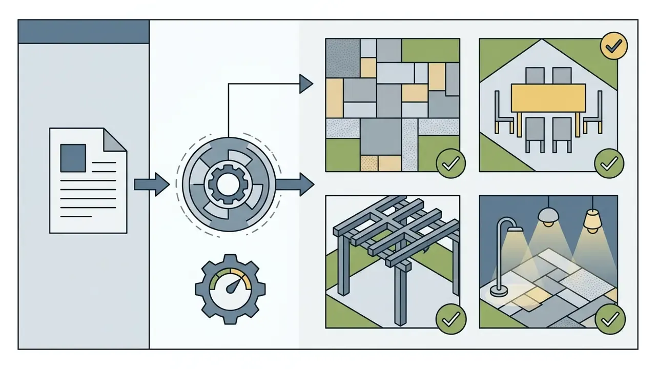


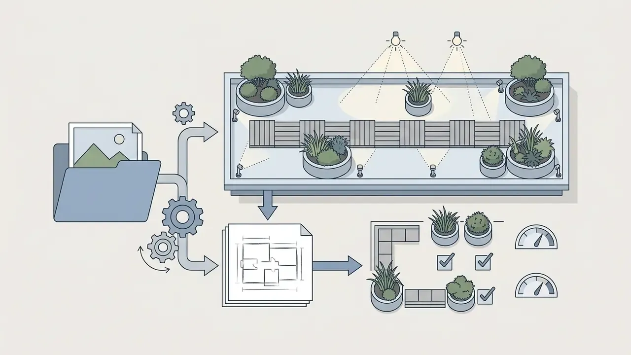
Segmentation research explains why these zones can be handled separately. Layout models encode roads, buildings, softscape, hardscape, and water bodies as distinct classes, and that is exactly what lets a tool repaint a lawn while leaving the house façade untouched.
When updating existing visual assets for marketing collateral, teams often reach for an ai image replacer to swap individual furniture items or plant groups without regenerating the surrounding layout.
Style directions for low-maintenance and decorative landscapes
AI design tools handle decorative and functional landscape philosophies with equal ease. Water-wise frameworks such as xeriscaping rely on drought-tolerant planting, gravel beds, and drip-irrigation zones to produce a sustainable low-maintenance yard. Note the categorical difference, because tool presets blur it: Modern, Cottage, and Minimalist are aesthetic descriptors, while xeriscape is a water-conservation framework built on seven principles, namely planning and design, soil analysis, appropriate plant selection, practical turf areas, efficient irrigation, mulch, and maintenance.
| Landscape Style | Key Visual Elements | Primary Functional Benefit | Ideal Soil / Climate Application |
|---|---|---|---|
| Modern Minimalist | Clean geometric lines, concrete pavers, sparse planting, metal edging | Low maintenance, uncluttered architectural focus | Urban lots, flat terrain |
| Xeriscape / Desert | Native succulents, gravel mulch, boulder accents, zero turf | Minimal irrigation, high drought resistance | Arid zones, water-restricted regions |
| Cottage Garden | Densely planted flowering perennials, timber arbors, gravel paths, informal beds | High biodiversity, rich visual texture | Temperate climates, organic soil |
| Mediterranean | Terracotta pots, olive trees, stone paving, shade pergolas | Heat tolerance, structured outdoor living | Warm, dry summer zones |
| Japanese Zen | Moss ground covers, raked gravel, bamboo features, stone lanterns | High tranquility, structured balance | Shaded areas, high humidity |
| Scandinavian Bio | Natural wood decking, native grasses, granite boulders, fire pits | All-weather utility, eco-centric layout | Cold climates, wooded slopes |
| French Formal | Symmetrical boxwood hedges, gravel axes, central fountain, potted citrus | High visual order, prestige property framing | Flat terrain, high-maintenance budgets |
| Australian Native | Drought-hardy eucalyptus, banksias, timber sleepers, decomposed granite | Wildlife attractant, minimal water dependence | Poor soil, fire-prone bushland borders |
| Meadow / Naturalistic | Mixed wildflower seeding, mown circulation paths, informal massing | Pollinator support, very low mowing frequency | Open sun, lean soils |
| English Classic | Clipped hedging with mixed borders, brick edging, lawn panels | Balanced ornament and structure | Temperate, reliable rainfall |
Style choice quietly decides which tool you need. A preset-driven browser visualiser covers a single Modern or Cottage concept perfectly well. Formal symmetry, hydrozoned xeriscape plans, and multi-zone commercial schemes need masking, negative prompts, and higher export resolution. That practical gap sets the criteria for the next section.
How to Choose the Best Free AI Landscape Generator
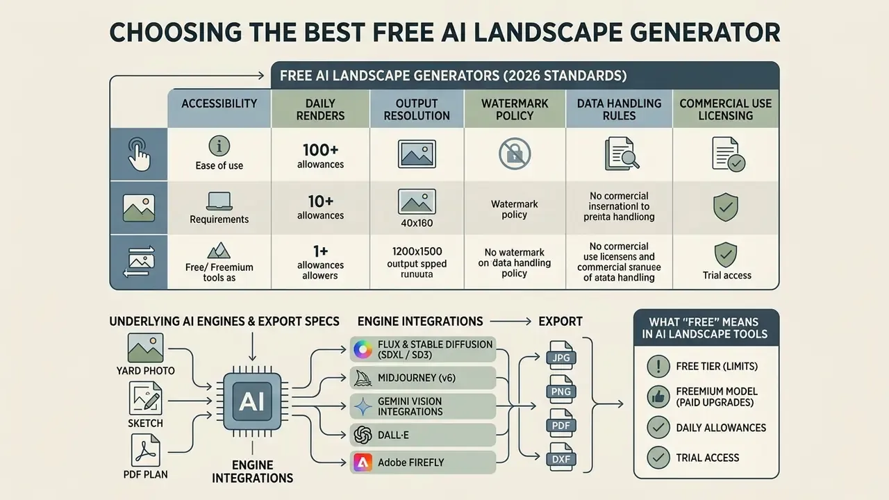
Choosing the best free ai landscape generator means evaluating accessibility, daily rendering allowances, output resolution, watermark policy, data-handling rules, and depth of style customisation. Plenty of online platforms advertise free ai tiers. Your actual requirements decide whether a basic browser visualiser is enough or an advanced web suite is warranted.
To evaluate broader tool categories across image synthesis platforms, review our AI Media Comparison breakdown.
Underlying AI engines and export technical specifications
Different platforms deploy different diffusion architectures, and that choice shows up directly in rendering fidelity and editing flexibility:
- Flux and Stable Diffusion (SDXL / SD3) Preferred for high spatial compliance, custom inpainting, and control over precise structural boundaries through ControlNet and LoRA fine-tunes.
- Midjourney (v6) Strong on photorealistic aesthetic concepts, foliage realism, and ambient lighting accuracy. It lacks native precision masking, which matters more than people expect.
- Gemini Vision integrations Used for automated site assessment, plant-list reasoning, and text-to-prompt optimisation ahead of visual rendering.
- DALL·E and Adobe Firefly Cited in USDA Forest Service landscape-planning guidance as stakeholder-facing ideation engines. Firefly is trained on Adobe Stock, openly licensed, and public-domain content, which matters for commercially sensitive work.
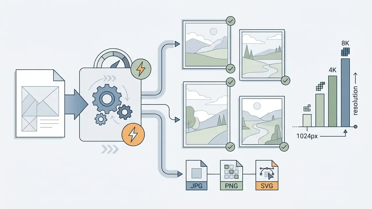
Supported export formats: Verify export specs before you start a project, not after. Web previews default to compressed JPG, while client presentations need lossless PNG. Some platforms also export vector overlays (SVG) that scale into CAD or Adobe Illustrator workflows, and professional suites add layered TIFF and PSD, PDF plan sheets, or GLB and OBJ 3D models. Typical resolution ceilings: 1024px on free tiers, 2K on entry paid plans, 4K to 8K on professional plans.
Comparison of free and freemium AI landscape generators (2026 standards)
| Tool / Platform | Free Tier Limits | Watermark Policy | 3D & Style Controls | Export Quality & Formats | Data Privacy & Retention | Model Training on Uploads | Commercial Usage Rights |
|---|---|---|---|---|---|---|---|
| Sad AI / web visualisers | 1 to 2 daily credits after free registration | None on basic exports | Preset style filters, basic prompt field | Standard 1024px, JPG/PNG | Cloud-stored history, no published enterprise retention policy | Not contractually excluded on free tier, assume possible | Personal use only |
| ArchyBase / Spatial AI | 1 free generation, no credit card | Light corner watermark | 189+ outdoor style presets, 3D aerial views | High resolution 2K, JPG/PNG | Project-based cloud storage, account-bound | Check plan terms; opt-out is typically paid-tier only | Requires paid plan upgrade |
| Neighborbrite | Unlimited basic web generations | No visible watermark | Style selection, brush-based masking | Standard web resolution, JPG/PNG | Browser-based, no published enterprise DPA | Not disclosed in public terms | Restricted under terms of service, no commercial endeavours unless specifically approved |
| Gendo-class professional suites | Free render without credit card, watermark removed on paid plans | Watermark on free tier | Photo or sketch input, reference-image style control, lighting and seasonal studies | High resolution, PNG/JPG, plan exports on paid tiers | Vendor-published security statement, project-level access control | Enterprise plans typically exclude training on client uploads | Included on paid plans for client presentations and marketing |
| Midjourney (paid / advanced) | No free tier, subscription required | No watermark | Advanced prompt control, reference images, style weighting | High quality up to 4K upscale, PNG/JPG | Public gallery by default on lower tiers, Stealth mode on higher tiers | Prompts and images used per platform terms unless Stealth or enterprise terms apply | Included on paid commercial plans, extra conditions above $1M annual gross revenue |
Read that table as a snapshot, not a contract. Vendor terms in this category change faster than the documentation does.
What "free" means in AI landscape design tools
In this market, "free" almost always means freemium, governed by credit caps, resolution limits, or feature locks. An ai landscape generator free tier may grant one to three renders per day, or a one-time allocation of sign-up credits. Observed patterns include 25 credits per month, 125 one-time credits, and 66 credits per day depending on the vendor. An ai backyard landscape generator free plan usually sits at the low end of that range.
As a widespread market practice, not a universal technical rule, free tiers compress final exports to standard web resolutions (commonly 720p, 1024×1024, or 1536×1536) and may overlay a brand watermark. Check the specific caps per vendor, since these terms move constantly. Advanced capabilities such as high-resolution download, commercial licensing, priority queues, and precise inpainting sit behind the paywall. If you want zero-friction access, review our roundup of free AI image generators without sign-up.
That compression research explains the economics behind the ai free landscape generator offer. Distilled models are cheap enough to serve at near-zero marginal cost in a browser, which is why vendors can advertise unlimited "basic" generations while reserving full-weight models for paid plans.
Features that matter before choosing a design tool
Before committing to a platform, check the technical features that actually affect landscape planning accuracy:
- Photo inpainting and maskingThe ability to select a single region, such as a lawn, and modify only that zone while the house and mature trees stay untouched. Inpainting needs the original image plus a mask, and on SDXL pipelines may also require selecting base and refiner checkpoints.
- Negative promptsA dedicated field (exposed in APIs as
negative_prompt) for excluding unwanted elements: "no concrete, no tall trees, no plastic furniture." - Reference image conditioningSupport for uploading style reference photos to guide colour palettes and materials. Reference guidance extends control beyond the text-token vocabulary and can disentangle colour from style.
- Model selectionAn exposed
base_modelor pipeline choice, so you can switch between Flux, SDXL, SD3, or a vendor-tuned landscape checkpoint. - Transformation strength controlLower strength preserves the original site footprint; higher strength produces bolder but less faithful layouts.
- Resolution exportThe option to export high resolution files fit for client presentation or print.
For teams running wider digital media pipelines, knowing how to ai image remove object helps strip debris and clutter from site photos before the layout model ever sees them.
How Realistic Are AI Landscape Design Results?
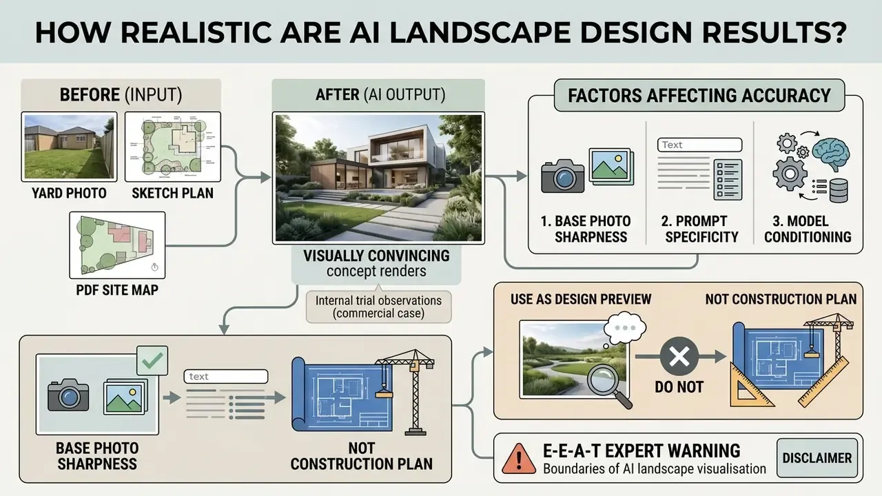
Current advanced ai landscape generators produce visually convincing, photorealistic concept renders. Their outputs reflect visual plausibility, not engineering accuracy. Peer-reviewed evaluations show diffusion models capture spatial layout and lighting well, while frequently failing on botanical accuracy and precise material dimensions.
«UrbanGenAI reaches high segmentation IoU and CLIP text-image alignment scores, yet these metrics measure visual quality rather than construction accuracy.»
What affects the accuracy of a generated landscape image
Visual realism and spatial coherence in an ai landscape image generator depend on three inputs:
- Base photo sharpness High-resolution, unblurred site photos let segmentation algorithms delineate boundaries accurately. NIST notes that generative processing can add artificial pixel information, so a low-quality source may actually look better while drifting further from reality.
- Prompt specificity Detailed prompts naming specific materials ("bluestone pavers," "decomposed granite ground cover") produce cleaner textures than vague descriptors like "nice yard." US Department of Energy prompting guidance makes the same point: clear, specific prompts are critical for reliable output.
- Model conditioning Systems using structural controllers such as ControlNet or LoRA retain real-world depth and site perspective far better than unconstrained text-to-image models.
Academic studies of generative AI in urban design add a caveat worth holding onto: visual similarity scores such as CLIP and cosine metrics can reach high levels while the model still introduces material inconsistencies or misreads complex spatial geometry (Generative Artificial Intelligence in Urban Design, 2025).
Use AI results as a design preview, not a construction plan
An AI-generated landscape image is a conceptual preview and a conversation starter. Never an installation-ready construction document. The model generates pixels from statistical patterns, with no access to physical engineering parameters, soil mechanics, or drainage math. Industry drawing conventions draw the same line explicitly: sketches and concept studies "shall not be used for fabrication or construction purposes," while construction drawings are the dimensioned, coordinated documents issued for physical installation work.
A complete landscape construction plan requires physical site measurement, grading analysis, utility location, and botanical selection tied to USDA hardiness zones. HUD's Fundamentals of Landscape Architecture links drain spacing and depth directly to soil type and climate. White House CEQ guidance directs designers to account for the full hydrologic cycle. Municipal development services commonly require a soil management report with lab analysis before a planting plan is approved. Treating an AI image as a blueprint invites structural failure, poor drainage, and dead plants. For client-facing presentation quality, run approved concepts through AI image upscalers rather than trying to extract measurements from them.
E-E-A-T expert warning: boundaries of AI landscape visualisation
Can You Use AI Landscape Images for Commercial Projects?
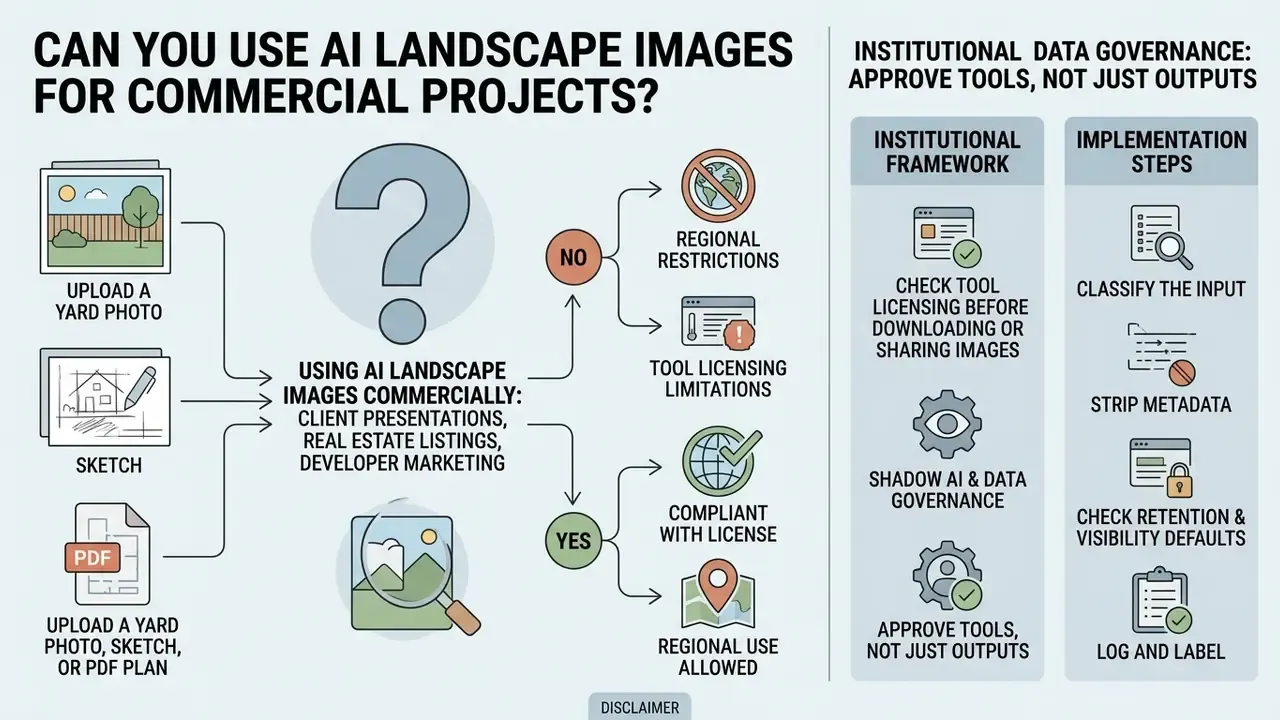
Using AI landscape images commercially, in client presentations, real estate listings, or developer marketing, depends on the licence granted by the tool vendor and on regional disclosure rules. Commercial plans often grant full usage rights. Output transparency obligations still apply.
Organisations comparing licence terms across vendors can start with our overview of AI image generators for commercial use, track ai image tools news for regulatory developments, and view the guide to active disputes over training data and generated output.
Check tool licensing before downloading or sharing images
Before publishing or monetising AI renders, read the platform's Terms of Service on intellectual property and commercial exploitation. Many free platforms restrict generated images to non-commercial, personal evaluation. One popular yard visualiser states outright that its sites may not be used for commercial endeavours unless specifically approved.
Under US Copyright Office guidance, purely AI-generated visual content lacking substantial human creative input cannot be registered for copyright protection, and applicants must disclose AI-generated material while identifying the human-authored contribution (US Copyright Office AI Guidance). The European Union AI Act (Article 50) mandates machine-readable marking and clear public disclosure for synthetically generated or altered commercial imagery (EU AI Act Text). Real estate professionals using AI-staged yard photos must disclose virtual staging to avoid deceptive advertising claims. The National Association of Realtors' brokerage AI policy guidance goes further, prohibiting altered neighbourhood demographics and misuse of copyrighted or trademarked material in enhanced listing images. Where provenance has to be verified before publication, AI image detectors offer a practical screening step.
Shadow AI and institutional data governance
Uploading photographs of client properties, gated communities, or unreleased development sites is a data-handling decision, not merely a creative one. Set a short internal policy before staff start experimenting with free tools:
One more control, often skipped: name an owner. If no single person is accountable for the render library, nobody can answer the audit question of where a published image came from.





When AI concepts are useful for professionals and clients
For landscape architects, real estate agents, and property developers, AI concept generation delivers real operational gains during early client discussions:
- Rapid client pitching Produce three distinct visual styles inside the first consultation and read the client's preference immediately.
- Moodboard creation Assemble palettes for materials, hardscape, and plant combinations before CAD drafting begins. Professionals selecting a primary engine for this stage can consult our comparison of the best AI image generators.
- Property marketing previews Show prospective buyers the visual potential of an unimproved or neglected yard.
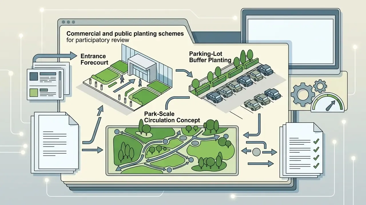
- Participatory planning Generate options for public or stakeholder meetings, a use case documented in 2025 landscape-planning literature on community participation.
Specialised professional workflows
FAQ About AI Landscape Generators
Do I need to download software to use an AI landscape generator?
No. Most modern generators run entirely online as cloud applications in a standard web browser. You upload photos, configure prompts, and render high-resolution output without installing anything locally or owning a serious GPU. Browser delivery also brings platform independence across mobile, desktop, and laptop, plus centralised updates, so every user on the team runs the same model version.
Can AI generate ideas for more than one outdoor space?
Yes. AI tools process photos from multiple distinct zones on a single property: front yards, backyards, side courtyards, patios, pool surrounds. You can generate individual concepts per zone or hold one unified design style across several site photos. Some platforms accept batch uploads of up to four images at once, handy for portfolio owners covering several parcels in one project.
Can I control lighting, seasons and visual mood?
Yes. Text prompts and parameter controls adjust lighting, seasonal appearance, and atmospheric weather in the render. Terms like "golden hour sunlight," "dusk illumination with warm landscape lighting," "blue hour twilight," "light morning fog," or "autumn foliage" change environmental conditions while the underlying site geometry stays fixed.
What file formats and sizes can I upload?
Most tools accept JPG, JPEG, PNG, and WebP, and many accept PDF site plans. File-size caps commonly run from 16MB to 50MB per image. Professional suites extend this to CAD and BIM inputs such as DWG and IFC.
In which formats can I export the final render?
JPG and PNG are near-universal. Some platforms add SVG vector overlays, layered PSD or TIFF, PDF plan sheets, or GLB and OBJ 3D models. Free tiers typically cap resolution around 1024px; paid tiers reach 2K, 4K, or 8K.
Which AI models power these generators?
Common backends include Flux, Stable Diffusion (SDXL and SD3) with ControlNet or LoRA conditioning, Midjourney for photorealistic aesthetics, and Gemini or DALL·E and Firefly integrations for prompt reasoning and stakeholder-facing ideation.
Can I submit an AI render for a planning application?
Only as illustrative material, and only where the reviewing authority permits it. AI renders are concept images, not dimensioned construction or landscape documentation. They do not substitute for stamped drawings, grading plans, or soil reports.
Do I need design experience to get a usable result?
No formal training is required. Anyone looking for a first concept can upload a photo, pick a preset, and get something presentable. The gap shows up later: reading which render is physically buildable still takes professional judgment, which is why the botanical and drainage review stays in the loop.
Conclusion
An ai landscape generator from photo is a fast, accessible way to visualise property improvements and test landscape styles online. By converting static site photographs, sketches, and 2D plans into photorealistic concepts, these tools close the distance between imagination and spatial planning. To capture the value without inheriting the risk, use AI-generated images to drive creative exploration and client alignment, and rely on qualified landscape professionals to translate the concept into an engineered, site-appropriate construction plan.