An AI map generator is an automated system that uses machine learning models, latent diffusion pipelines, or procedural content generation (PCG) algorithms to turn text prompts, parameters, or reference images into geographic and spatial maps. Modern map generator ai tools can produce static visual map imagery, interactive browser layers, grid-aligned game layouts, or printable 3D relief models built for worldbuilding and tabletop play.
One naming note before we go further. The same tool class gets searched as map ai generator, ai maps generator, ai mapping generator, map ai maker, map maker ai, and even the common misspelling ai map creater. Different words, same product category.
Executive Summary
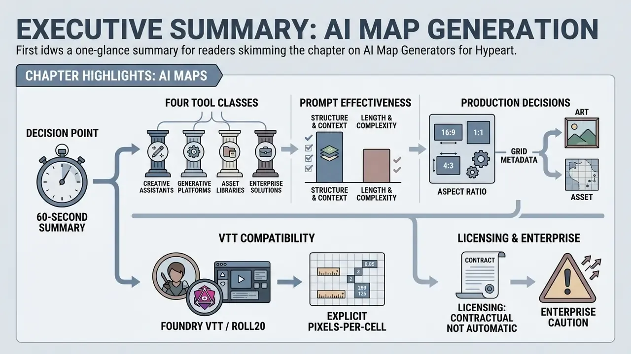
For readers who need the decision in 60 seconds:
- Four tool classes, not one. An
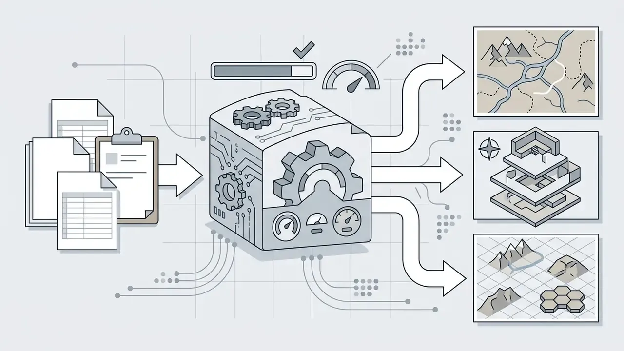
ai map image generatoroutputs raster art (PNG/JPEG/WEBP). Anai game map generatoroutputs playable, grid-calibrated scenes (.dd2vtt, Universal VTT). An interactiveai map makeroutputs vector/GIS layers (SVG, GeoJSON, PDF, HTML embeds). Anai 3D map makeroutputs meshes (STL, OBJ, GLB, FBX) for 3D printing and game engines. - Prompt structure beats prompt length. Five explicit fields (map type, camera view, terrain, style, palette) outperform long adjective chains. Corpus research on 72,980 Stable Diffusion prompts confirms that subject + medium + technique + genre + mood + lighting + resolution is the highest-performing pattern.
- Aspect ratio is a production decision.
16:9for widescreen VTT displays and video backdrops,1:1for square dioramas and printed tiles,3:4for portrait lorebook pages,21:9for ultra-wide monitors. PDF matters for multi-page campaign books and print shops. - Grid metadata is the line between "art" and "asset." Foundry VTT and Roll20 need explicit pixels-per-cell values (commonly 70px or 140px; Foundry enforces a 50px minimum grid), and functional exports pack walls and lighting alongside the image.
- Licensing is contractual, not automatic. Purely AI-generated outputs are not registrable for exclusive copyright in the U.S. without meaningful human authorship, yet vendor subscriptions can still grant commercial usage rights. Terms differ per platform and change over time.
- Enterprise caution. Do not upload confidential floor plans, cadastral data, infrastructure layouts, or client deliverables to public generative endpoints without a reviewed data-handling policy.
How to Use This Guide (Three Reader Paths)
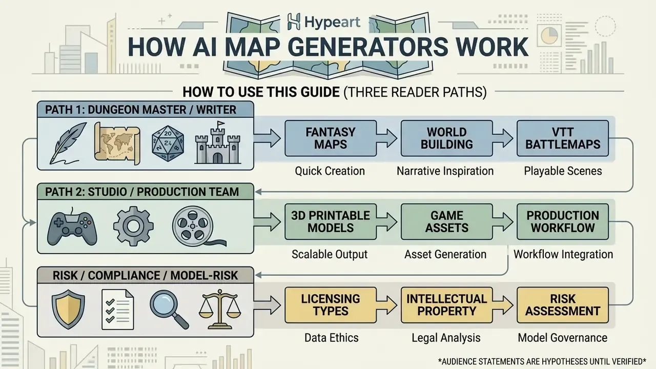
Not everyone arrives here with the same question, so pick your lane.
Path 1: the Dungeon Master or writer. You want a fantasy map or a battlemap tonight. Read the prompt sections, the aspect ratio matrix, and the grid metadata part. Skip the governance material; it will not help you draw a coastline.
Path 2: the studio or production team. You care about repeatability, resolution, export formats and licence tiers. The workflow, seed-logging and commercial-use sections matter most, plus the free-tier checklist so nobody ships a watermarked asset on a paid product.
Path 3: the risk, compliance or model-risk reader. Your question is narrower: who uploaded what, under whose contract, with what evidence trail. Sections on data protection, Shadow AI and deployment models were written with you in mind. Generative imagery is usually classified as low-stakes creative tooling, right up to the moment somebody feeds a branch floor plan into a public endpoint.
Every audience statement here is a working hypothesis until backed by analytics, interviews or customer research. Treat it as such.
What Is an AI Map Generator and Which Maps Does It Create
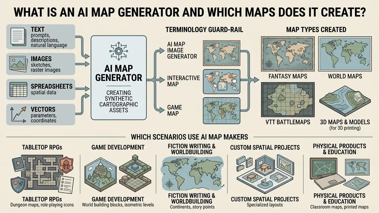
An AI map generator is software that converts user inputs (natural language text, raster images, spreadsheets, vector parameters) into synthetic cartographic assets. These tools automate ai map creation, letting creators generate world maps, custom maps, fantasy map graphics, and tactical game map layouts in seconds without manual drafting.
"Procedural content generation is the automatic creation of game content by algorithms; maps and levels remain the most studied content types."
What an ai map creator actually produces depends on the architecture underneath. Diffusion-based systems generate visual map image assets. Procedural and neural-procedural hybrids derive structured coordinate grids, elevation heightmaps, or interactive GIS pin layers. Same category label, very different data.
Terminology guard-rail (important for enterprise readers). The phrase "map generator" lives in two unrelated technical domains. Here it means geographic and spatial map generation: cartographic imagery, game scenes, terrain meshes. It does not mean AI system mapping or model inventory mapping, which refers to governance tooling used to catalogue models, data lineage and Shadow AI inside an organisation. If your objective is an AI asset register rather than a fantasy coastline, you need GRC/MRM tooling, not a diffusion model. The section on enterprise controls explains where the two worlds intersect.
AI Map Image Generator, Interactive Map and Game Map
An ai map image generator creates 2D visual representations exported as standard raster files such as PNG or JPEG. These static outputs serve illustrative and concept-art purposes, where aesthetic quality and cartographic style outrank navigation data. Because the rendering engine underneath belongs to the same model family used for general artwork, it is worth comparing options against mainstream AI image generators before you commit to a map-specific subscription.
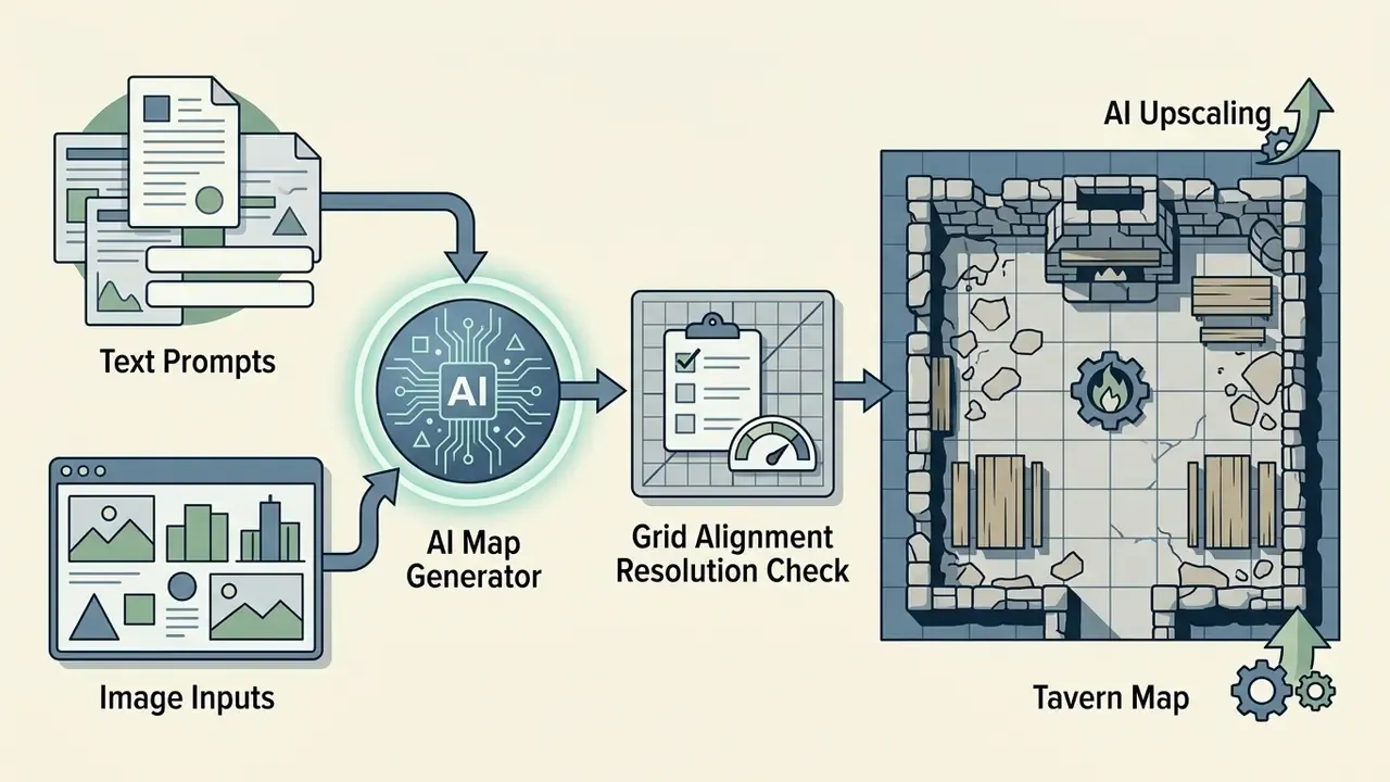
An interactive map, by contrast, processes geocoded data points so users can pan, zoom and click spatial markers. An ai game map generator goes a third way: functional level layouts with grid lines, square-cell coordinate systems and collision data built for virtual tabletops (VTTs) or game engines. A decorative map is a picture. A game map is a data file that happens to look like a picture.
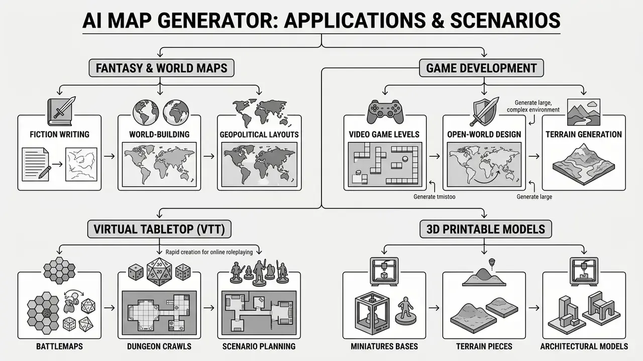
Which Scenarios Use AI Map Makers
Creators across game development, literature and digital media use ai map makers to speed up spatial design and worldbuilding. Key application scenarios:
How AI Map Creation Works: From Description to Finished Map
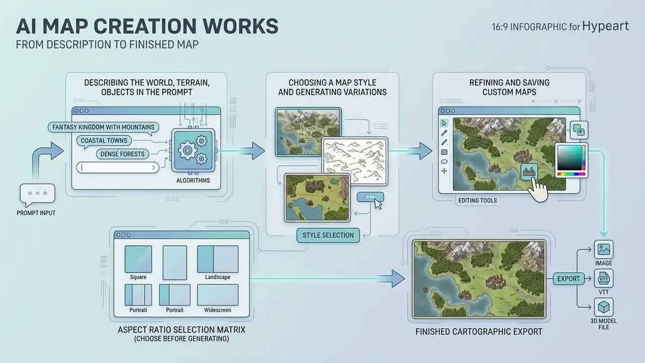
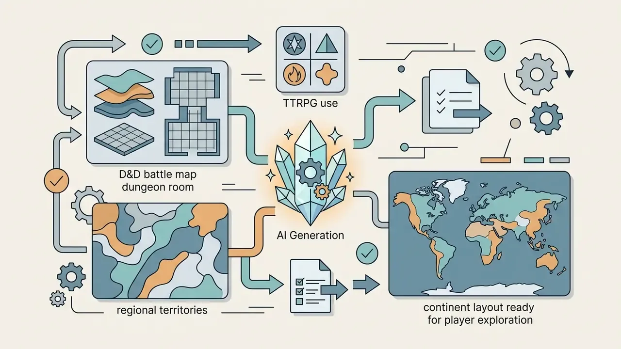
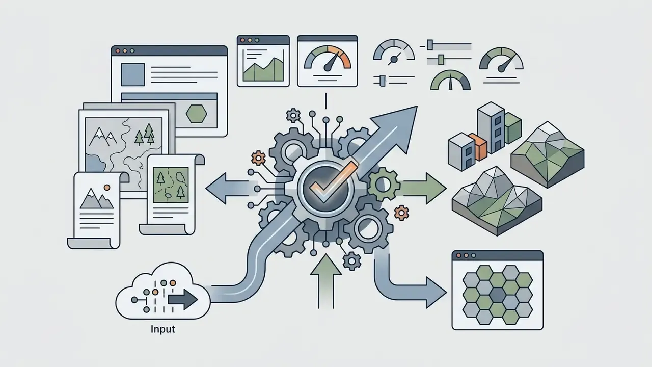
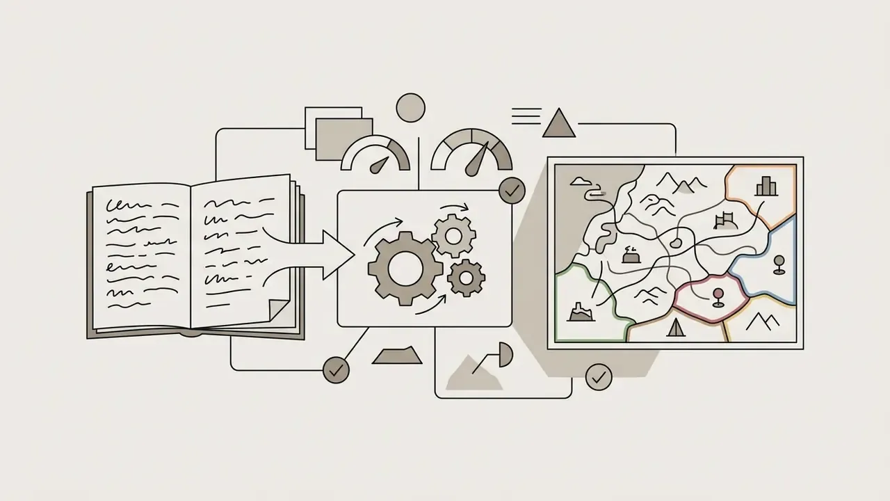
AI map creation follows a fairly stable workflow that turns a concept into a finished cartographic export. Understanding the pipeline lets you pick sane ai map creator parameters and keep visual control over the geography.
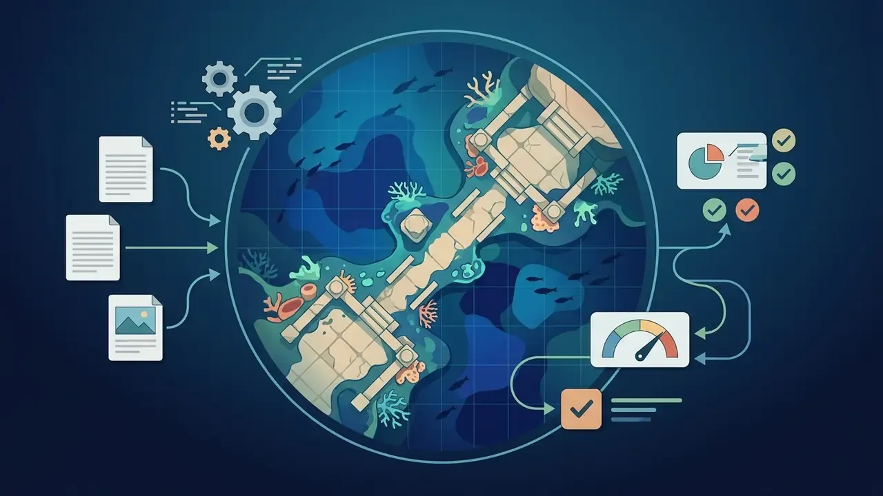
Modern ai map generators synthesise terrain, rivers, coastlines and structures by interpreting prompt tokens through text encoders, or by combining procedural noise with trained neural layers. Documented production workflows across vendor platforms converge on five stages: write the prompt, generate candidates, review and refine, edit and save, then publish or export.
Describing the World, Terrain and Objects in the Prompt
A good prompt for an ai generator map opens with a clear geographic subject, terrain features and spatial composition. Name the landmass structures (archipelagos, mountain passes, continent coastlines), the key landmarks (capital cities, ancient ruins) and the intended world context.
"Moonshine delivers steerability through plain text while preserving structural fidelity to the source PCG algorithm."
In practice: structured descriptors such as obstacle density, corridor connectivity and biome adjacency produce navigable geography. Vague adjective stacks produce pretty, structurally random artifacts. Pleasant to look at, useless to play on.
Where biome logic matters (which forest borders which desert, where a river can plausibly run), research pipelines derive elevation first and place biomes second. Latent-diffusion terrain work such as MESA (CVPRW, 2025) generates 2.5D terrain from text prompts using global Copernicus data, and multi-biome systems like AutoBiomes distribute biomes across vast terrains by climate and topology signals rather than prompt keywords alone. Practical takeaway: describe elevation and hydrology first, then vegetation and settlements.
Choosing a Map Style and Generating Variations
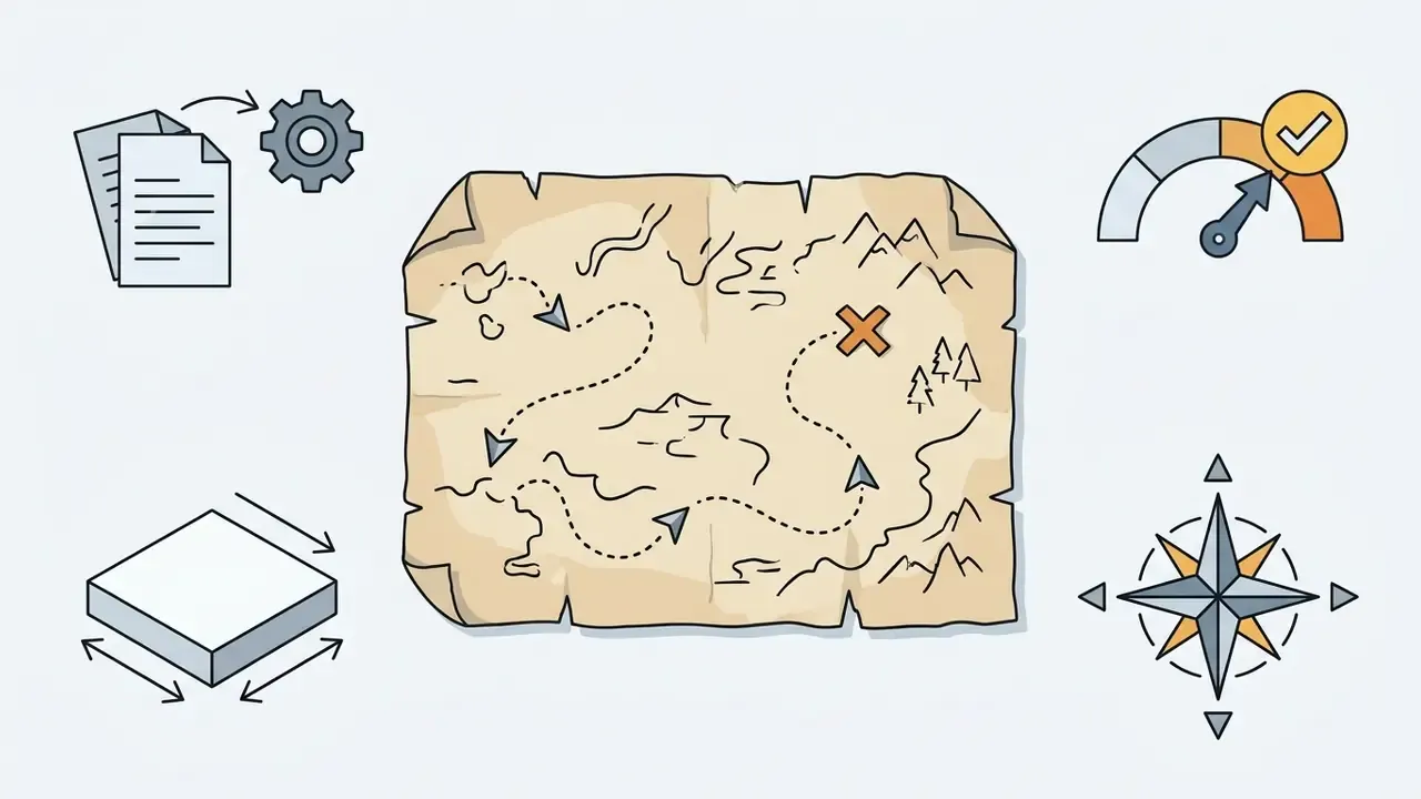
The map style you select dictates how the model renders detail, lighting, line weight and texture. Popular directions: hand-drawn fantasy parchment, top-down tactical grids, isometric 3D views, satellite-style terrain.
When you trigger the ai generate step, the system returns several candidate drafts. Designers judge them for structural plausibility, compare variations, then adjust noise seeds or prompt parameters to refine feature placement before locking a final draft.
Reproducibility tip: lock the camera or view phrase first, change only one or two tokens per iteration, and record the seed. That habit separates exploratory generation from a repeatable production pipeline. It also happens to be the thing an auditor asks for later.
Refining and Saving Custom Maps
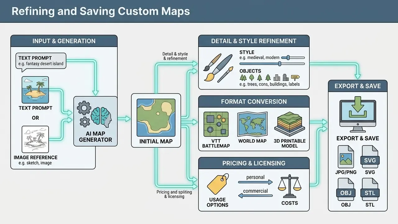
Once a draft exists, post-processing tools let you modify, refine and export custom maps. Advanced map creator ai platforms offer localised editing through inpainting, vector scaling, layer toggles and marker placement. For colour correction, texture cleanup or watermark-free retouching, general-purpose AI photo editors are usually faster than re-rolling the whole map.
Final exports are saved in formats matched to their end use: raster (PNG, JPEG, WEBP) for general illustration, vector (SVG, PDF, EPS) for crisp print scaling, or structured packages carrying alignment metadata for digital game environments. In professional GIS toolchains, PDF export is the format that preserves georeference, annotation, labelling and feature attributes, which makes it the safest choice for printable lorebooks and multi-page campaign supplements. Before you ship anything, confirm the commercial use terms for AI-generated images attached to the tier you exported from.
Aspect ratio selection matrix (choose before generating, not after):
| Aspect ratio | Best for | Typical pitfall |
|---|---|---|
16:9 (landscape) | Widescreen VTT displays, video backdrops, stream overlays | Cropped corners when reused in print |
1:1 (square) | Battle map tiles, 3D diorama bases, social previews | Wasted canvas for wide regional maps |
3:4 (portrait) | Lorebook pages, A4/Letter print, novel inserts | Awkward on wide monitors |
21:9 (ultra-wide) | Panoramic continent maps, ultrawide monitors, banners | Detail loss when downscaled to mobile |
AI Map Generator from Image: Creating a Map from a Reference
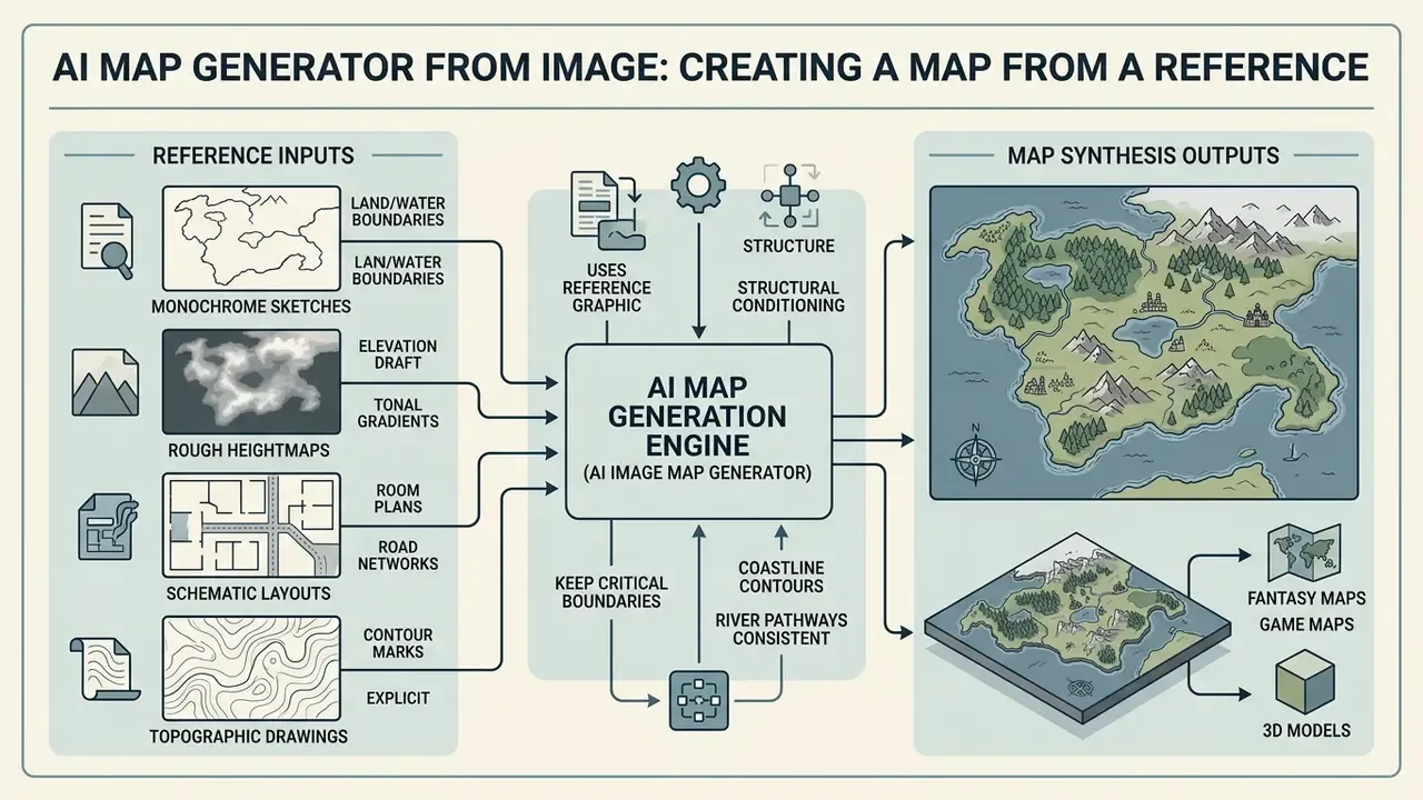
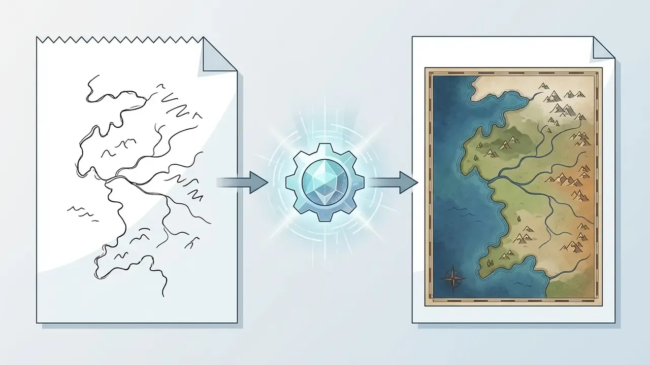
An ai map generator from image uses a reference graphic (a hand sketch, a rough topographic draft, a satellite image) as structural conditioning for synthesis. This image-to-image route preserves layout geometry while applying new artistic styles or environmental detail. If you are evaluating tools specifically for this workflow, our breakdown of image-to-image generators compares control depth and licensing side by side.
Using an image map generator ai keeps critical boundaries, coastline contours and river pathways consistent across iterations, which avoids the random drift common in pure text-to-image generation.
Which Images Are Suitable for Map Generation
For decent results with an ai image map generator, reference images need clear, high-contrast structural outlines and readable geographic shapes. Suitable inputs:
- Monochrome hand-drawn sketches defining land and water boundaries.
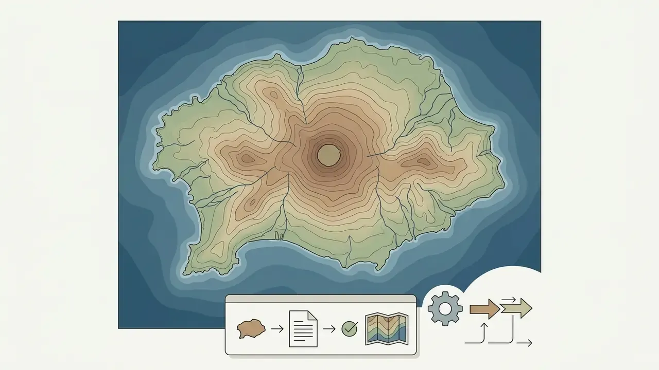
- Rough heightmaps or elevation drafts with clean tonal gradients.
- Schematic layouts detailing room plans or road networks.
- Clean topographic line drawings with explicit contour marks.
- Screenshots of real map services (Google Maps, Apple Maps, satellite views) when the goal is a stylised version of a real location.
"Real height maps from the Tangrams Heightmapper let the network transfer morphological terrain traits while preserving the original spatial structure."
Image-quality practice from measurement standards applies here too: a graphic element is only usable if it clears minimum size and contrast thresholds. A faint pencil coastline scanned at 72 DPI will not survive conditioning. A clean, high-contrast outline at 1500px or more will.
How to Combine an Image with a Text Prompt
AI Game Map Generator for Fantasy Maps and Game Worlds
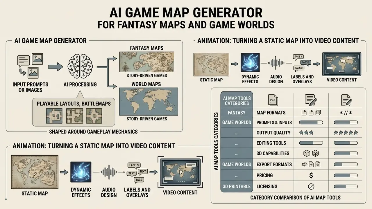
An ai game map generator specialises in playable layouts, battlemaps and world settings shaped around gameplay mechanics. Unlike purely decorative tools, these systems account for spatial flow, tactical grid positioning, line-of-sight obstacles and navigational paths.
Dedicated map generators make sure generated worlds, dungeons and encounter spaces actually support player interaction, token movement and Virtual Tabletop (VTT) integration.
"A two-agent Actor-Critic architecture for 3D map generation in Unity reached 80% successful outcomes versus 60% for a single-agent baseline across 10 independent trials."
Academic systems also show why constrained generation beats free-form image synthesis for playable content. Designer-controlled 3D map generation with snappable meshes gives immediate navigability feedback and cuts authoring time compared with fully manual creation, while procedural multiplayer map generators validate balance and flow that a diffusion model never checks. A pretty dungeon with three dead ends and no exit is still a broken dungeon.
Fantasy Maps and World Maps for Story-Driven Games
Building fantasy map graphics and continental world maps gives narrative context to campaigns and RPGs. Such a map is a reference document: it depicts biomes, mountain ranges, ocean routes, settlement locations and political borders in one coherent visual theme.
When writing prompts for campaign settings, designers balance lore against visual readability, leaning on established styles such as antique parchment or detailed cartographic ink to set atmosphere. For the illustrative layer (heraldry, faction sigils, cover art that matches the map), general-purpose AI art generators usually give wider style control than map-specific tools.
When You Need a Playable Map, Not Just a Map Image
A decorative map image works as background art or lore illustration. A functional game map needs embedded grid metadata, square-cell scale markers, wall collision definitions and support for a lighting data layer.
Platforms such as Foundry VTT and Roll20 require maps configured with exact pixels-per-grid-cell parameters (70px or 140px per square are the common values). Foundry's scene configuration exposes grid type, grid size in pixels and grid alignment as separate overlay settings, enforces a minimum grid size of 50px, and draws the grid on a dedicated canvas layer instead of baking it into the bitmap. Note: these parameters come from platform documentation and community standards. They are versioned product settings, not peer-reviewed findings, and should be re-checked against your VTT release. Functional game map generators export Universal VTT files (.dd2vtt) that pack grid scale and dynamic lighting walls alongside the primary image.
"MAP-Elites generates diverse FPS maps by filling a multi-dimensional feature space (openness, linearity, choke points) with high-quality playable levels."
Animation: Turning a Static Map into Video Content
A static map can become an immersive video backdrop for online sessions or channel reviews. Three stages:
This is the layer most map guides skip, and it is where Dungeon Masters and channel owners squeeze the most reuse out of one asset: a single continent map becomes a session recap intro, a character-introduction backdrop and a campaign trailer. Our YouTube video editing workflow guide covers the publishing side, and the animation maker overview explains which motion features are worth paying for.
Category Comparison of AI Map Tools
| Tool category | Primary output | Main use case | Inputs | Quality criteria |
|---|---|---|---|---|
| AI Map Image Generator | Raster image (PNG, JPEG) | Illustrations, concept art, fantasy map concepts | Text prompt, reference images | Visual quality, style match, detail level |
| AI Game Map Generator | Grid map, level files (.dd2vtt, grid layers) | Game locations, D&D battlemaps, VTT platforms | Text, grid parameters, PCG seeds | Traversability, balance, grid alignment, no dead ends |
| AI Map Maker (Interactive) | Interactive vector/GIS layers | Custom web maps, place navigation | Text, location lists, spreadsheets, URLs | Geocoding accuracy, marker customisation, interactivity |
Extended Characteristics Matrix for AI Map Tools
| Tool category | Export formats | Aspect ratio | Primary scenario | Key technical requirements |
|---|---|---|---|---|
| AI Map Image Generator | PNG, JPEG, WEBP | 16:9 (landscape), 1:1 (square), 21:9 (ultra-wide) | Illustrations, lorebooks, concept art | High DPI, no artefacts along grid lines |
| AI Game Map Generator | .dd2vtt, PNG (no grid), Universal VTT | 16:9, 4:3, custom by cell count (e.g. 30×20) | VTT platforms (Foundry, Roll20), print | Exact 70/140px alignment, wall and lighting data |
| AI 3D Map Maker | STL, OBJ, GLB, FBX | 1:1 (square base), circular diorama | 3D printing, physical models, game engines | Manifold mesh, wall thickness above 1.5 mm |
| Interactive AI Map Maker | Vector SVG, GeoJSON, PDF, HTML embed | Dynamic (responsive canvas) | Web maps, navigation, GIS | Geocoding precision, layer and marker support |
AI 3D Map Generator: Volumetric Maps and 3D-Printable Files
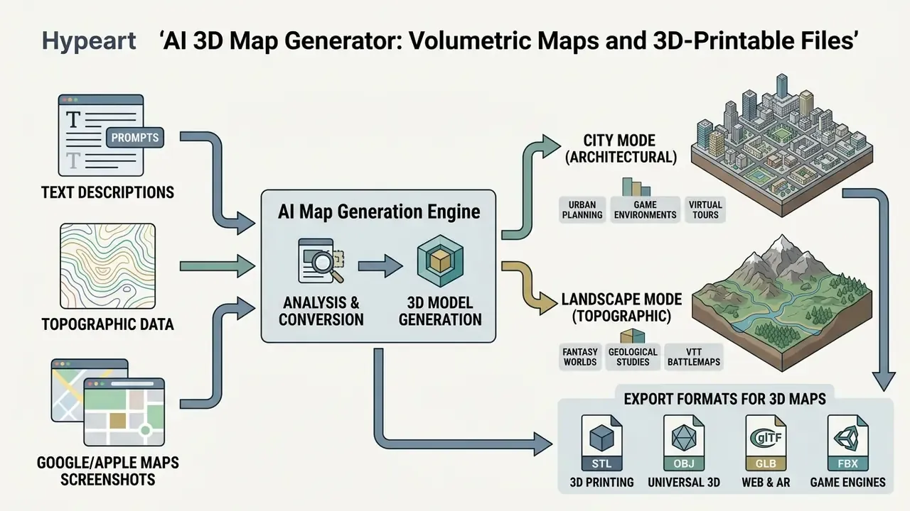
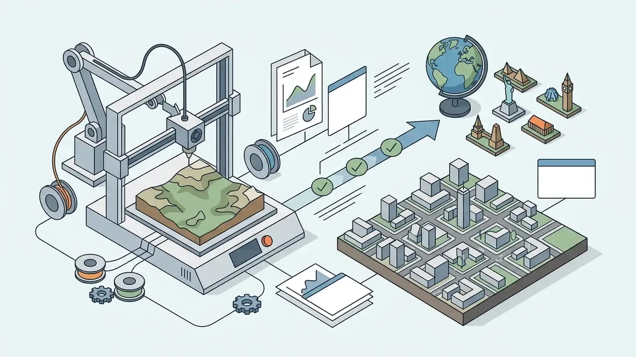
Modern ai 3D map generators convert text descriptions, topographic data, or Google/Apple Maps screenshots into three-dimensional polygonal models. Unlike a 2D raster, a 3D map delivers actual relief geometry (a heightmap mesh) or volumetric urban massing, ready for import into game engines (Unreal Engine, Unity) or output on an FDM/resin printer.
The practical appeal is speed. A typical AI 3D map pipeline runs image generation first (1 to 2 minutes) and mesh reconstruction second (3 to 4 minutes), delivering a print-ready model in roughly 4 to 6 minutes without CAD or GIS expertise.
Generation Modes: City Mode vs Landscape Terrain
3D map algorithms split object handling into two dominant modes:
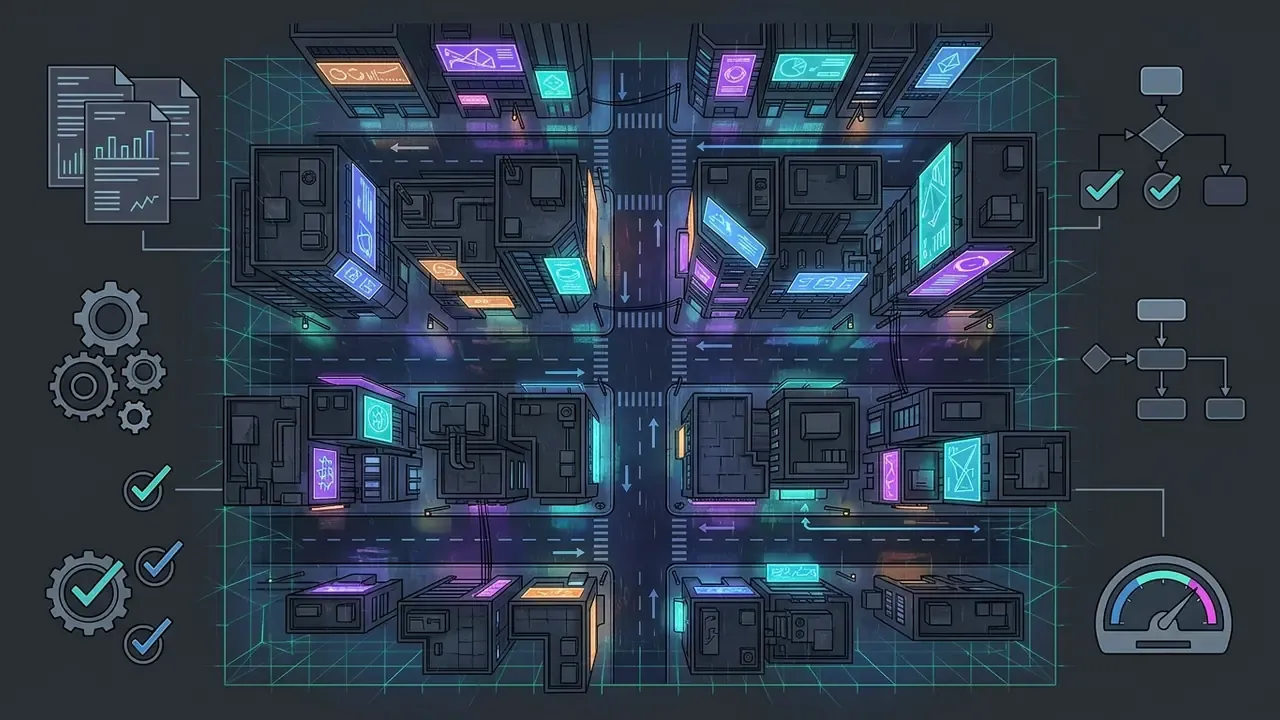
- City Mode (architectural) focuses on procedural buildings, road grids, bridges and urban landmarks. The mesh is optimised with flat faces and thickened walls to prevent print defects and fragile spires.
- Landscape Mode (topographic) emphasises elevation change, so mountain ridges, canyons, valleys, river beds and coastlines dominate. Uses elevation data (DEM) to build pronounced raised relief.
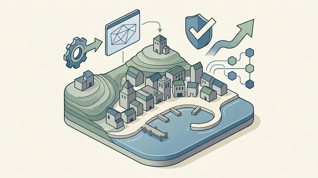
Choose City mode for a recognisable skyline or a district diorama. Choose Landscape mode for national parks, island chains, lake regions and any terrain where elevation is the story. Two stylistic presets dominate the market: a sleek architectural maquette with bold block masses and smooth contours, and a miniature isometric diorama with soft textures on a rounded platform base. The second makes the better gift or shelf piece; the first makes the better presentation model.
Export Formats for 3D Maps
- STL the standard slicer format (Cura, PrusaSlicer, Bambu Studio, OrcaSlicer). Geometry only, no textures.
- OBJ widely compatible, supports texture maps; optimal for Blender, Maya and ZBrush.
- GLB compact binary glTF for web viewers, AR applications and lightweight engine imports.
- FBX Autodesk format for animation pipelines, Unity and Unreal Engine workflows.
What people actually print: miniature city replicas, raised-relief topographic maps, travel souvenirs and hometown gifts, classroom geography models, national-park terrain (Grand Canyon, Yosemite, Zion), tabletop terrain tiles for D&D and Warhammer, plus quick urban-planning or real-estate presentation models. Practical checks before slicing: confirm the mesh is manifold (watertight), keep wall thickness above roughly 1.5 mm, and verify the base is flat so the model does not need supports.
How to Choose the Best AI Map Generator: Free and Paid Capabilities
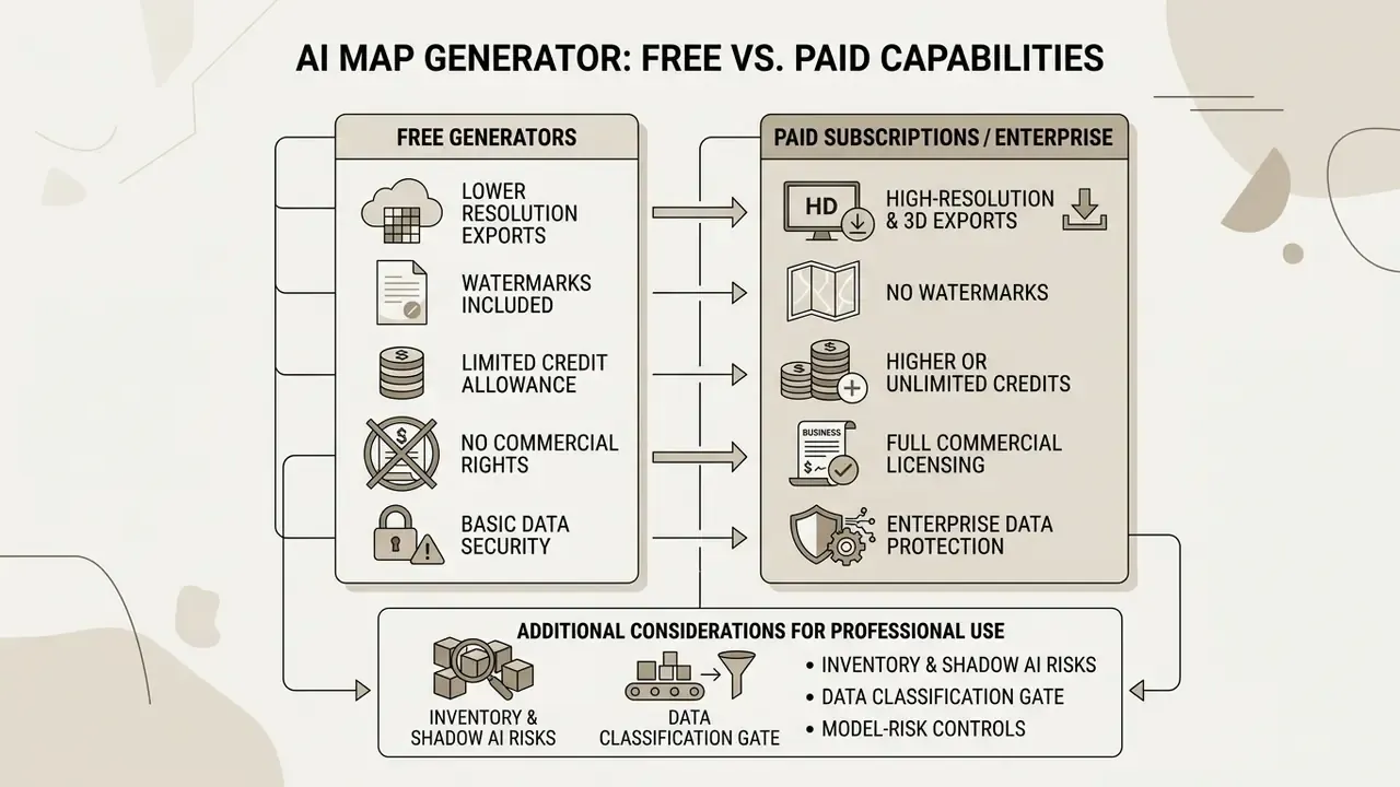
Picking the best ai map generator means weighing functional output against budget, export requirements and licensing terms. Access models range from a free ai map generator with daily generation credits to enterprise subscriptions with high-resolution commercial rights.
Knowing where the free tier stops prevents mid-production bottlenecks. Across the current market, paid tiers rarely add new kinds of output. They add quota, resolution, watermark removal, priority queueing and collaboration seats. Published 2026 price points for adjacent mapping and diagramming tools cluster between roughly $5 and $20 per editor per month, while credit-based 3D generation is often billed per job (for example, 40 credits per 3D map: 10 for image generation plus 30 for mesh reconstruction). If you need to model that against volume, browse the hub of cost calculators before signing an annual plan.
What to Check in a Free AI Map Generator Before You Start
Before committing to a free ai map generator or a free ai map maker, verify four technical constraints:
- Export resolutionfree tiers often cap exports at low resolutions (512x512 or 720p), which looks pixelated in print or when zoomed in a VTT. Side-by-side limits for the major platforms sit in our roundup of free AI image generators.
- Watermarkscheck whether free exports carry visible vendor logos or mandatory branding overlays on the map canvas.
- Credit limitsconfirm daily or monthly quotas, reset intervals and credit cost per high-resolution render. Published free allowances range from a handful of credits per day to fixed monthly pools (5, 10, 80 or 90 credits are common).
- Commercial rightsreview whether free-tier generations are restricted to non-commercial personal use or published under public attribution licences.
Add a fifth check for game use: does the free tier export a grid-free version of the image? A baked-in decorative grid that does not match your VTT cell size is worse than no grid at all.
Teams building broader generative pipelines can also compare adjacent utilities in our glossary, from the ai rewrite generator for lore and session notes to the ai schedule maker for asset production timelines and the ai rubric generator for evaluating creative output against fixed criteria. Design teams comparing software costs can review AI Media Pricing Guides for transparent structures, and studios automating batch generation should read the AI Media API notes on rate limits and licensing scope.
Commercial Use and Paid Tool Terms
"Purely AI-generated visual outputs cannot be registered for exclusive copyright protection without significant human creative input."
Under that guidance, copyright protection extends to the human-authored contributions in an AI-assisted work, with AI-generated portions disclaimed at registration. Commercial subscriptions from reputable ai map creation tools still grant contractual commercial usage rights to sell products containing generated assets. That contractual permission is separate from, and narrower than, exclusive copyright ownership. Our deep dive into commercial rights for AI images breaks down how vendor terms, attribution duties and resale restrictions interact, and the tracker of AI Litigation and Case Timelines shows how quickly the underlying disputes move.
Two failure modes recur in production. First, a map generated on a free tier later appears on a paid product cover, retroactively breaching the non-commercial condition. Second, reference images belonging to a client get uploaded to a public endpoint, creating an unlicensed derivative. Both are avoidable with a two-line asset log recording tool, tier, date, prompt and reference source. Boring, yes. Cheaper than a takedown.
Enterprise Data Protection, Shadow AI and Model-Risk Controls
Map generation looks harmless until the input is a real facility. Uploading floor plans, branch layouts, cadastral extracts, infrastructure diagrams, logistics routes or client deliverables into a public image-to-image endpoint can constitute a data transfer to a third-party processor, with implications under GDPR and GLBA, exposure to internal confidentiality policy, and retention terms nobody on your side negotiated.
Controls that map cleanly onto existing governance frameworks:
- Inventory and Shadow AI. Register every generative endpoint used by design, marketing and product teams. Unregistered image tools are a classic Shadow AI blind spot, precisely because they are read as "just art tools."
- Data classification gate. Prohibit upload of confidential spatial data (site plans, security layouts, geolocated customer data) to public tiers. Route that work to enterprise or on-premise deployments with contractual data-processing terms.
- Reproducibility and audit trail. Log prompt text, model and version, seed, reference image hash, output hash, operator and timestamp. Deterministic seeds turn generation into a repeatable, reviewable process, which is the minimum evidence auditors expect when a generated artefact reaches a published or client-facing deliverable.
- Output validation. Check generated geography for hallucinated features before publication (rivers running uphill, duplicated landmarks, invented place names) and record who approved the asset.
- Ownership and escalation. Name a single accountable owner per tool, define what that owner may approve alone, and document the escalation path when a request touches regulated or client-owned data. No evidence, no autonomy.
- Framework alignment. Where generative tooling touches regulated processes, existing model-risk and AI-risk guidance (NIST's AI Risk Management Framework, supervisory model-risk expectations such as SR 11-7 and OCC 2011-12 in U.S. banking) supplies the documentation, validation and ownership structure you can reuse instead of reinventing.
Deployment comparison:
| Deployment model | Data exposure | Typical fit | Governance effort |
|---|---|---|---|
| Public free tier | Highest; inputs may be retained or reused per ToS | Marcus Hale, author. | Low tooling effort, high policy risk |
| Public paid tier / API | Contractual, vendor-hosted | Commercial creative production | Medium: contract review, DPA, logging |
| Private cloud / self-hosted (open pipelines) | Lowest; inputs stay in tenancy | Confidential spatial data, regulated workflows | Highest: infrastructure, model ops, validation |
Disclaimer: regulatory references are illustrative. This is not legal, compliance or financial advice. Assess applicability with your own risk, legal and privacy functions.
How to Write a Prompt for an AI Map Generator
"An analysis of 72,980 Stable Diffusion prompts shows successful requests combine subject, medium, technique, genre, mood, lighting and resolution."
Task-decomposition research points the same way. Prompts perform best when they declare task background, input definitions and output requirements as separate blocks, and multi-step map workflows split the job into subject preparation, model selection, parameter selection, prompt engineering, generation and post-processing.
Which Details Make a Good Map Prompt
A complete map prompt carries five fundamental components:
- Map type and scope state whether the output is a fantasy world map, a regional continent map, a city plan or a top-down battle map.
- Camera view and perspective specify top-down orthographic, isometric 3D, or bird's-eye regional.
- Terrain and geographic details list landforms such as jagged mountain chains, winding river deltas, dense pine forests, coastal cliffs.
- Style and texture name the aesthetic: aged vintage parchment, hand-drawn ink illustration, satellite topography, 16-bit RPG grid.
- Colour palette and lighting define tone: sepia, vibrant biome colours, muted earth tones, dark moody lighting.
Two optional fields materially improve game-ready output: output constraints (aspect ratio, resolution, cells across) and negative prompts (no grid lines, no text labels, no characters, no border frame).
Prompt Directions and Examples for AI Maps
Proven templates across creative styles:
- Fantasy World Map: "A detailed fantasy world map of a vast archipelago, hand-drawn ink style on aged parchment, showing jagged mountain ranges, coastal harbor cities, dense ancient forests, a decorative compass rose in the corner, high contrast, crisp lines."
Prompt and Reference Preparation Checklist
Checklist0 / 12
FAQ: AI Map Generators
Is an AI map generator free?
Most platforms offer a free tier with credit limits, reduced resolution and often watermarks. Free output is frequently restricted to personal, non-commercial use. Commercial publication normally requires a paid subscription.
Do I own the maps I generate?
Vendor terms usually grant you the right to use, modify and often sell the output. That contractual right is not the same as exclusive copyright: in the U.S., purely AI-generated elements are not registrable without meaningful human authorship.
Which format do I need for Foundry VTT or Roll20?
A grid-free high-resolution PNG plus a documented pixels-per-cell value, or a Universal VTT (.dd2vtt) package that bundles grid scale, walls and lighting.
Can I 3D print a generated map?
Yes. Export STL and open it in Cura, PrusaSlicer, Bambu Studio or OrcaSlicer. Verify the mesh is watertight and wall thickness exceeds roughly 1.5 mm before slicing.
What aspect ratio should I choose?
16:9 for screens and video, 1:1 for tiles and diorama bases, 3:4 for printed pages, 21:9 for panoramic continent art.
Can I animate a static map?
Yes. Image-to-video models add fog drift, water motion and light flicker. Add ambient audio and animated labels, then export MP4 or WEBM for streams and video platforms.
Is it safe to upload real site plans?
Treat that as a data transfer. Use enterprise or self-hosted deployments with reviewed data-processing terms, and never upload confidential or client-owned spatial data to public free tiers. To evaluate software options, see the overview of tool comparisons, check licence questions in the commercial-use hub (see the overview), or consult AI Media Support and Troubleshooting for asset optimisation guidance.
Limitations and Open Questions
Appendix A: Superseded Fragments and Legacy References
Retained for transparency and version tracking:
- Superseded sourcing statement (prompt section)
- "Prompt engineering principles established in academic cartography frameworks, such as Dunkel et al. (KNJC, 2025), emphasize building requests around explicit spatial components rather than ambiguous descriptive adjective chains." Status: the underlying publication could not be verified in an accessible primary form. The methodological claim is preserved in the main text and is now supported by the corpus analysis of Dehouche & Dehouche (arXiv, 2023) and by task-decomposition prompting research. Where the workflow reference remains useful, it is described neutrally as "spatial prompting workflow research."
- Superseded internal link (image-to-prompt section)
- the previous workflow-automation reference was contextually unrelated to map production and has been replaced in the main text with an outpainting and canvas-expansion reference. Status: retained here because production-scheduling tooling can still matter at studio level, and it is now linked in a more appropriate context.
- Legacy category table
- the three-row category comparison (image generator, game map generator, interactive map maker) is retained alongside the extended matrix, because the shorter table remains the faster scan for first-time readers.
- Verification note on VTT parameters
- pixels-per-cell values (50px minimum, 70px and 140px common) and
.dd2vttpackaging derive from platform documentation and community standards rather than peer-reviewed literature. Re-check them against your current VTT release before batch-producing assets.